Author Archives: lakiw

Day 90: Three Months!

Miles Hiked: 13.2
Miles Left: 1404.5
Ending Location: Mile 780.8, Town shelter in Glasgow VA

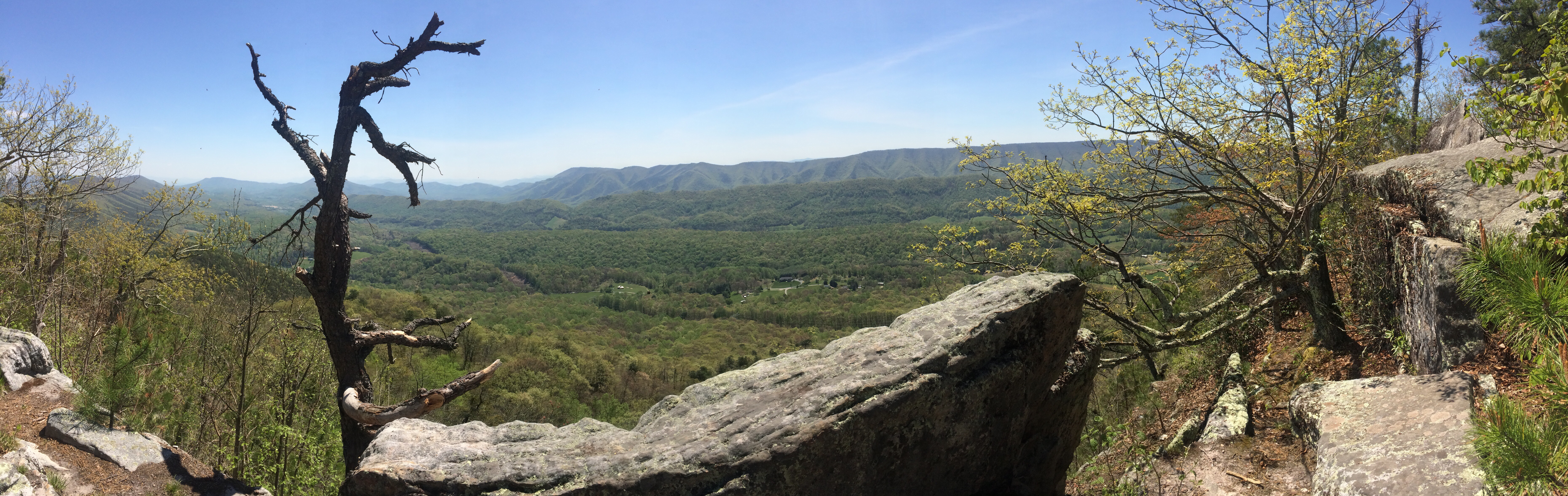
Today was one of the rare days where I was on the trail before 7am. I’ll admit part of it was that I wanted to get packed up before tourists started using the overlook, but watching the sun rise also had it’s motivating effects. That was good since if I was going to avoid hitchhiking I had to be at the parking lot before 3pm since Owl needed to return the rental car.

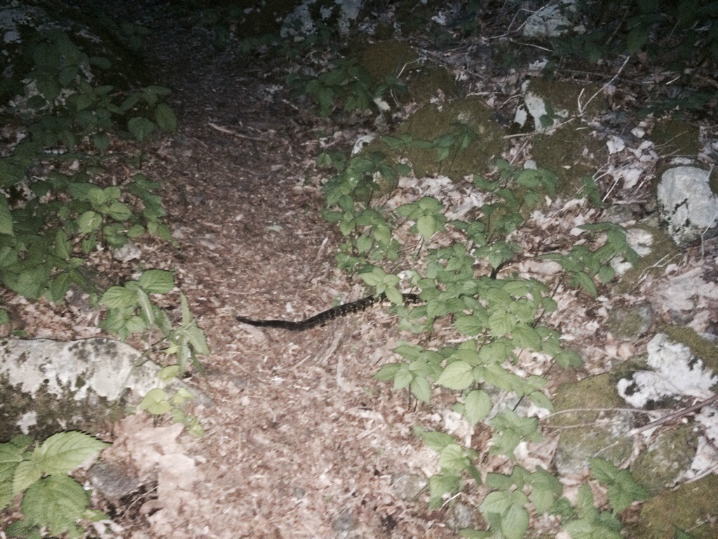
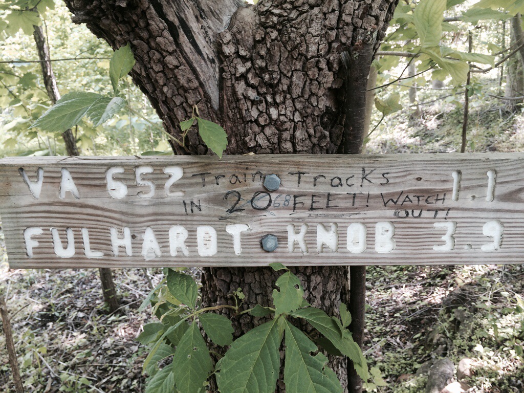
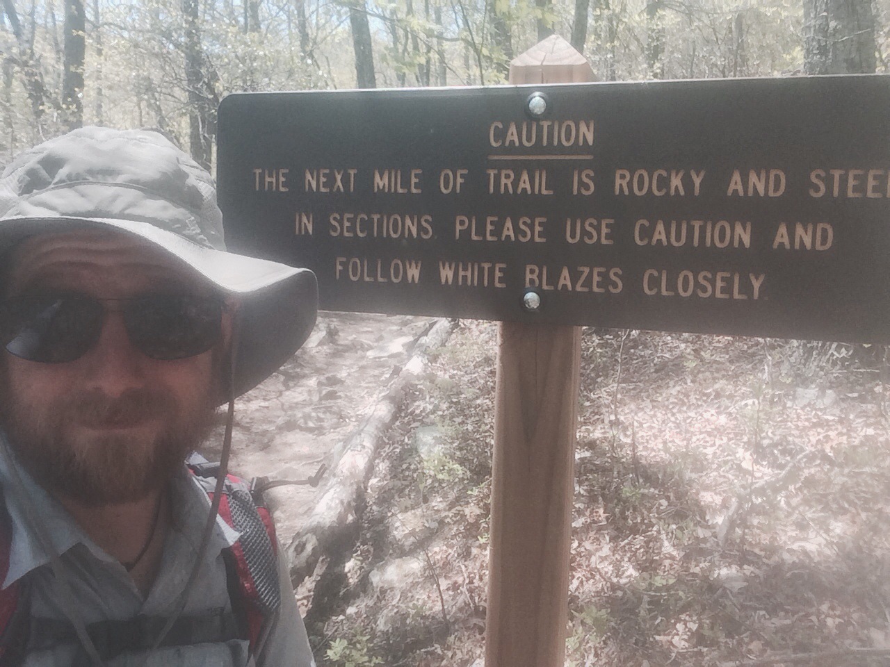
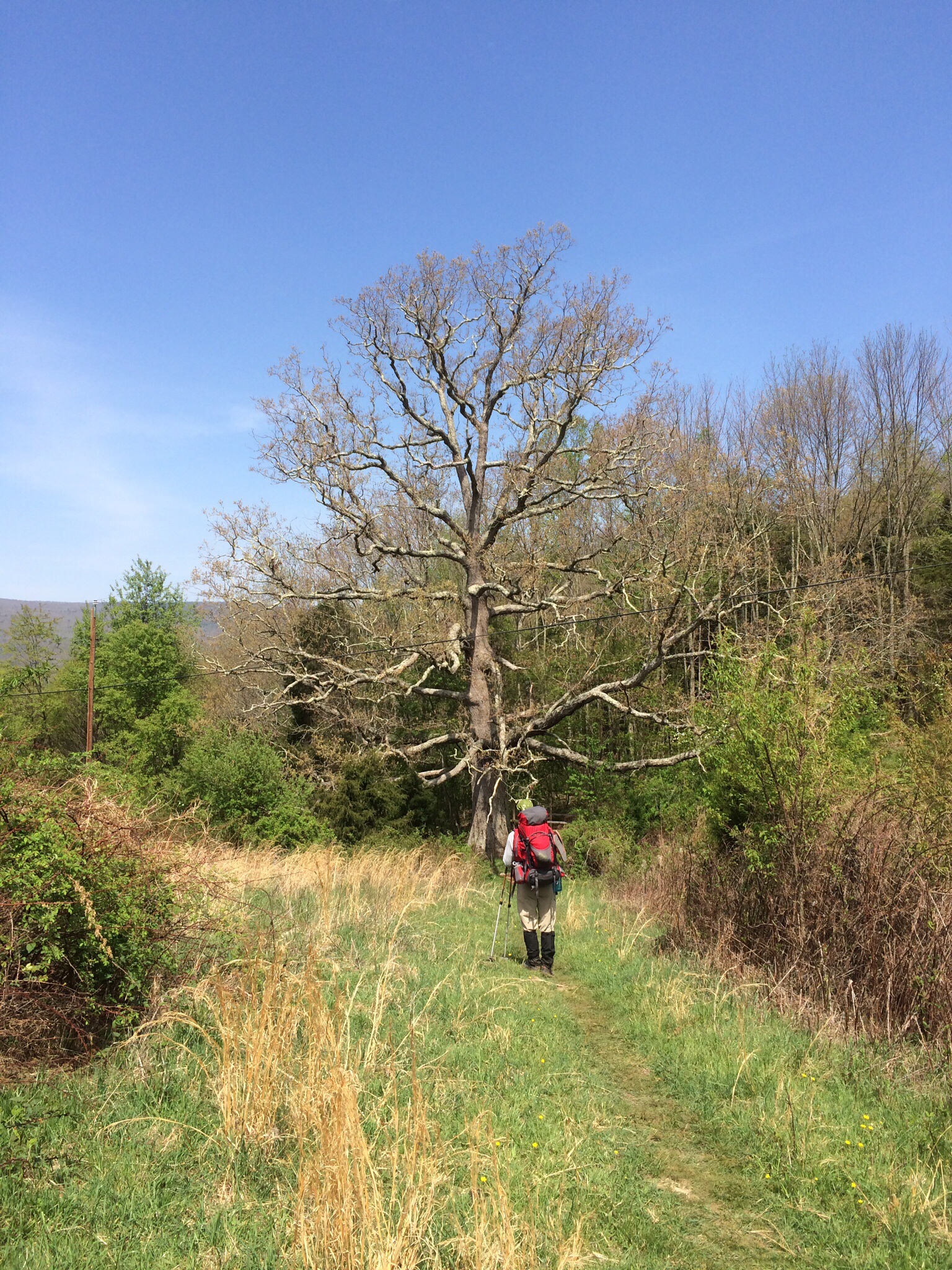
The weather was overcast and some fog rolled in later which was a welcome relief from the heat. Also with the exception of Highcock knob, (I swear I’m not making these names up), the trail was very well maintained so I made great time. I ended up hiking with Finn for a bit until he finally outpaced me. I hadn’t had many opportunities to hang out with him before and it was fascinating hearing his stories since this was his third through hike attempt. At one point we ran into a ginourmous black snake and Finn decided to play with it. It wasn’t venomous but the snake ended up pooping all over Finn. Lesson learned.

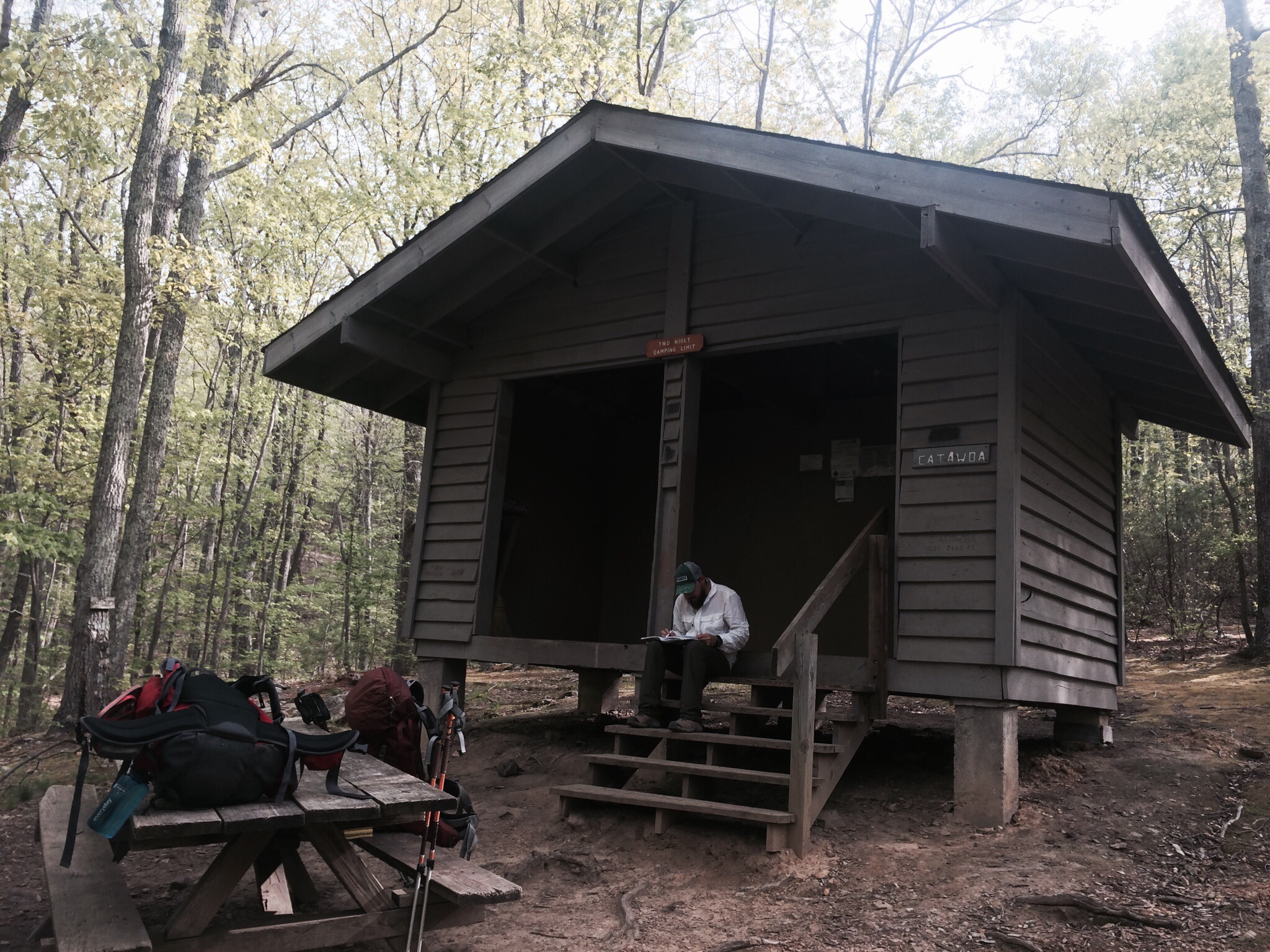
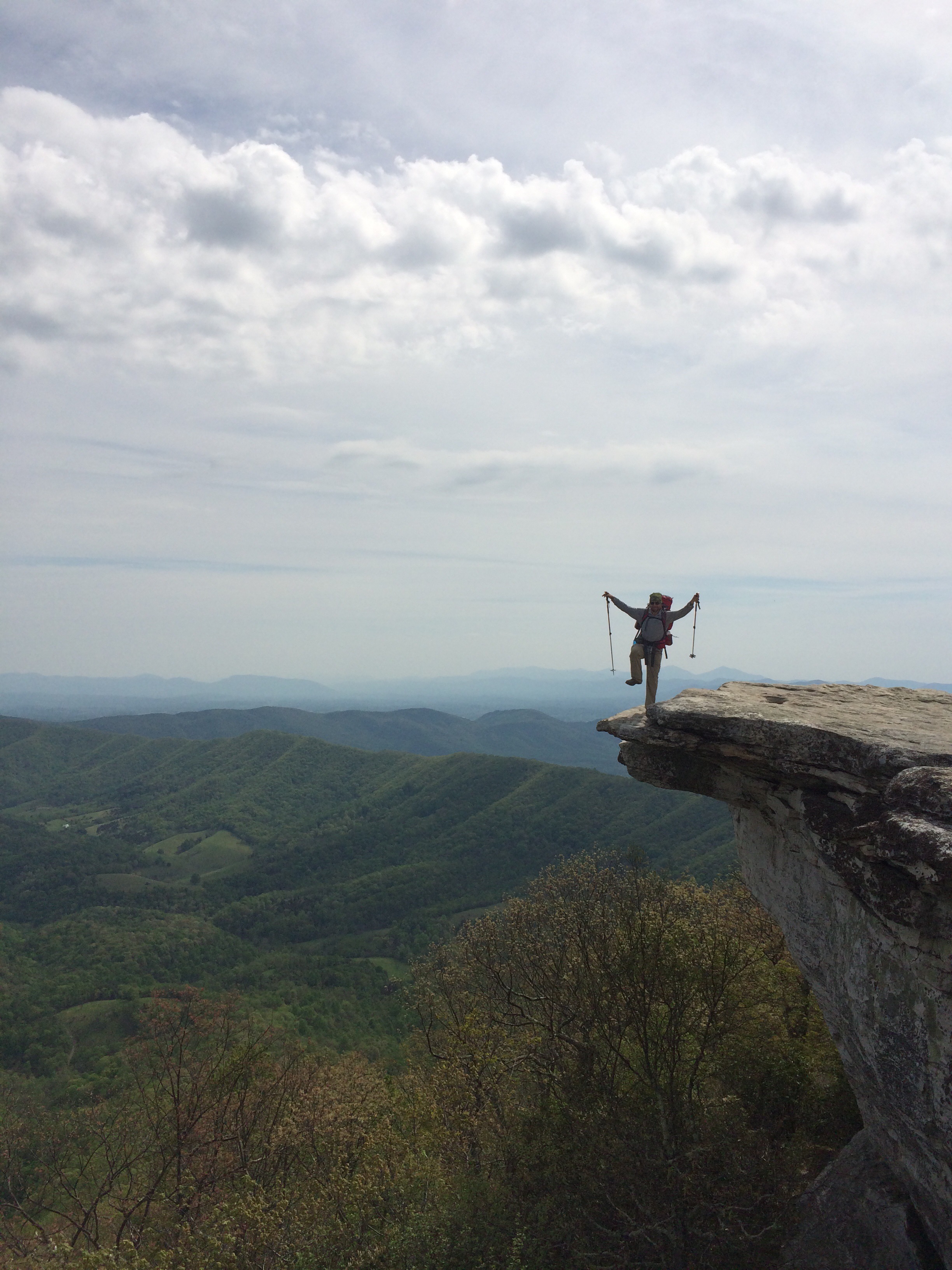
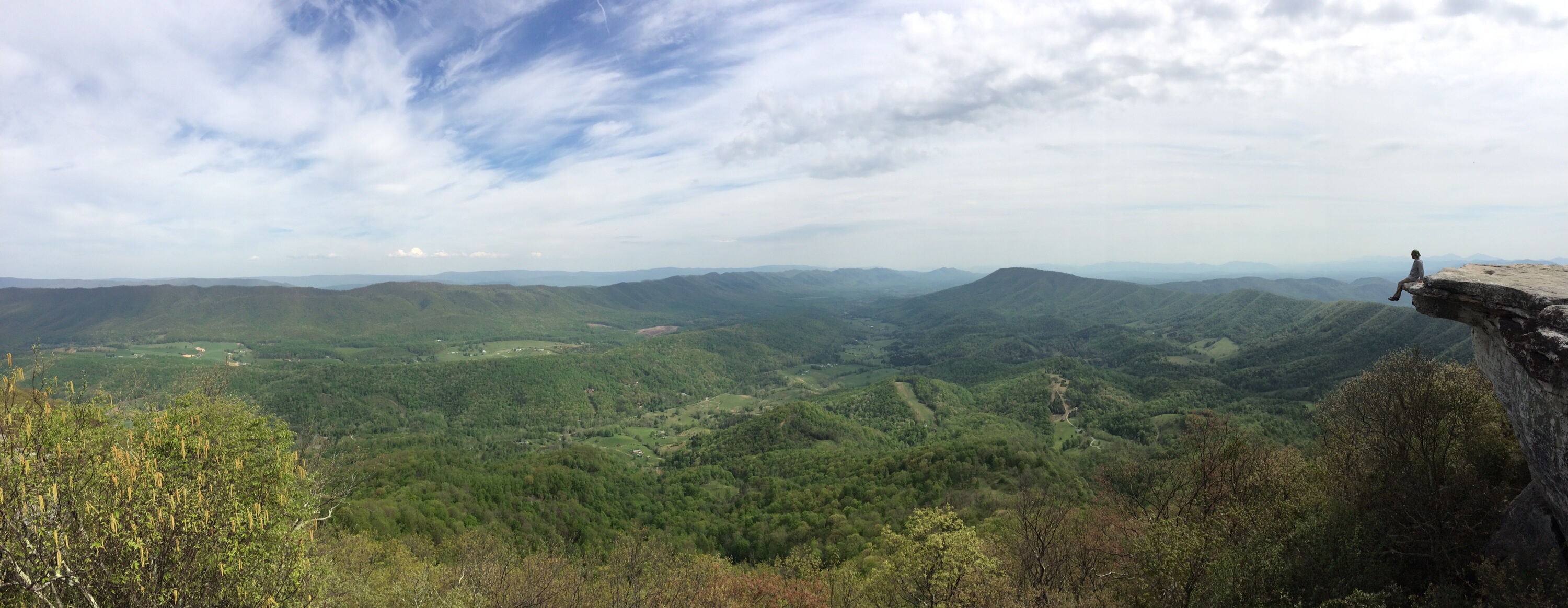
I stopped by Matt’s creek shelter for lunch. It was a good creek so I approve of the name. Then it was on to the James river where the trail was almost perfectly flat. After all the hills I almost didn’t know what to make of level ground. The James River footbridge to the parking lot was the last part of the trail for the day. It also was the largest pedestrian only footbridge on the AT. That really isn’t that impressive but all the guidebooks make a big deal out of it so I thought I should mention that fact. In the parking lot there was trail magic left by friends of Jay Hawk so I was able to rest in style. There were only two Krispy Cream donuts left though so I was very happy when two other hikers showed up to eat the second one. It had been torturing me as I didn’t want to be “that guy” who ate all the donuts. The two hikers were soaked since they had just jumped off the bridge and swum to shore. Apparently that’s an AT challenge. I’ll admit I was pretty lame since I didn’t go back and do that too. It takes a bit to psych myself up for doing something crazy. If they had told me about the challenge in the morning I probably would have jumped off that bridge but sitting in that parking lot with my belly full it just didn’t seem fun. As I said, lame.

While we were sitting there a couple of Hondurans who had been fishing came up and asked us what we were doing. Their English wasn’t that good and neither was our Spanish but we managed to convey the basic idea that we were walking from Georgia to Maine. They thought that was hilarious! They couldn’t imagine anyone doing such a stupid thing. One of the guys even borrowed my hiking poles and pantomimed hiking around the parking lot accompanied by funny facial expressions. I had a good laugh too but it really struck me how ridiculous what we’re doing is.

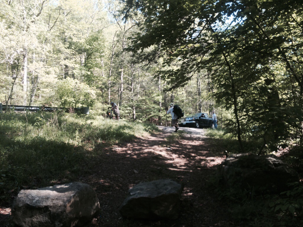
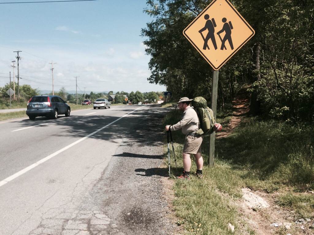
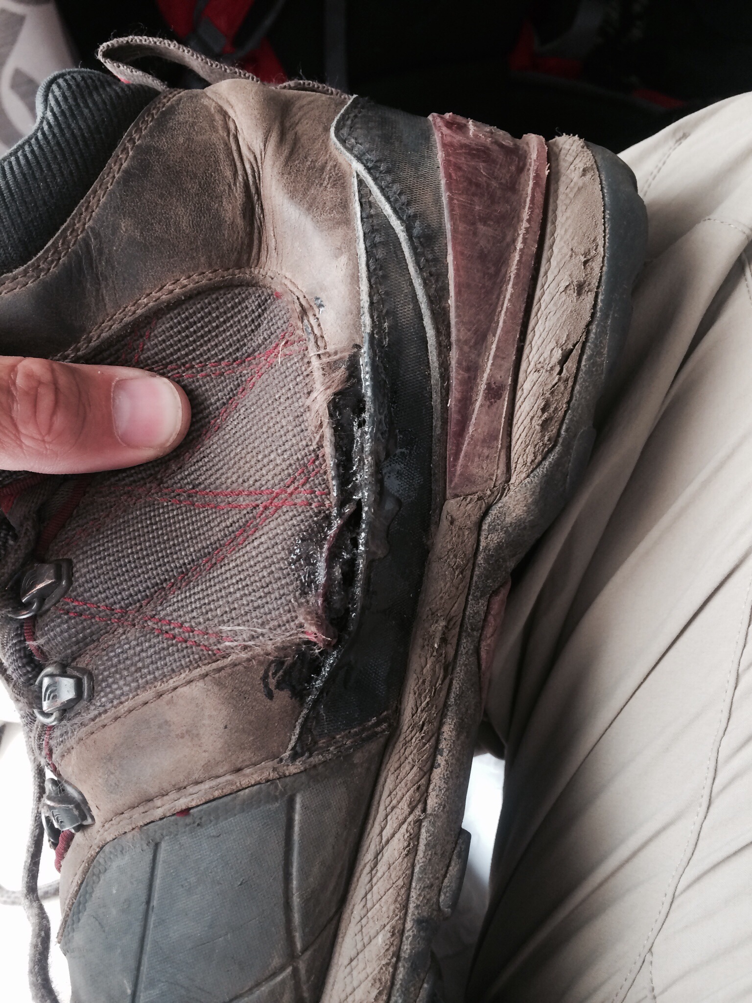
Around four Owl came screeching into the parking lot and yelled for me to get in. Besides me and him, Wiki and Lorax were in the car and then the two other hikers joined us so it was *packed*. We then drove to Glasgow and Owl kicked us out of the car in front of the Post Office before he raced back to the car rental place. I had gotten a care package from home with my old hiking shoes in it. My current boots were falling apart so that was a most welcome change. I’m going with a used pair of shoes for now since they are already worn in, and more importantly I figure anything I wear on the rocks in Pennsylvania are going to get trashed so I’ll save new shoes for after that.

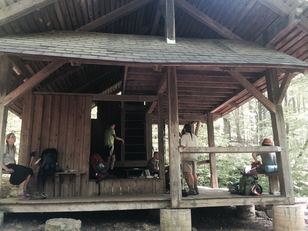
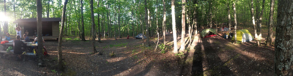
Then it was time for a shower, laundry, and food, in that order. The town of Glasgow had built a free hiker shelter in the park which was really neat and helps since the town didn’t have a hotel. Unfortunately they were still in the process of running electricity to it so there was no hot water. Despite that after a couple of days of sweating constantly that cold shower felt good. Dinner was at Scotto’s Pizza. The food was excellent which was fortunate since it was the only restaurant in town. They sat all the hikers in a back room which worked out really well as we were all able to swap stories without grossing out the other customers with our lack of personal hygiene and freakish appetites. After that it was a short walk back to the shelter where bunk beds had been set up for us to sleep in.

20140520-235322-86002416.jpg

20140520-235324-86004312.jpg

20140520-235324-86004996.jpg

20140520-235323-86003366.jpg

20140520-235322-86002895.jpg

20140520-235323-86003848.jpg

20140520-235325-86005610.jpg

20140520-235324-86004778.jpg

Day 89: Rattlesnakes and “Stealth” Camping

Miles Hiked: 15.4
Miles Left: 1417.7
Ending Location: Mile 767.6, Thunder Mountain Overlook

This morning we learned the downside of camping by a river in a valley as a fog had rolled down the mountain. Our tents were no defense against it and we awoke to a general dampness that soaked through all our clothing. Despite that things were warming up, (it was supposed to hit the mid 90’s in the afternoon), so we quickly dried off. Any thoughts of swimming in the river were short lived though when we saw a snake swimming in it. I’m getting better with snakes but still they freak me out enough that I wanted no part of that.

Wiki was having serious shoe issues, as in his new shoes were turning his feet into hamburger, so Owl volunteered to go into town and rent a car so that they could stop by an outfitter. Wiki couldn’t do that on his own as A) He didn’t have an American driver’s license, and B) Was only 19 so no car rental place would serve him. I on the other hand would continue hiking and then meet them in Glassgow in two days.

Today was all up with a quick hop over Fork mountain followed by a 3k elevation climb up Apple Orchard Mountain. Well I guess that means there was some down, but I don’t remember it 🙂 Around noon I took refuge in Bryant Ridge shelter, which was a good shelter to do so in as it had three levels and was fairly new. More to the point it was well ventilated which helped make the heat bearable. I stayed there for about three hours as the last thing I wanted to do was climb a mountain in 90+ degree heat. As I was laying there I thought I saw a mouse tail wriggling in the rafters until I realized it was another snake. It didn’t drop on me so we were cool with each other.

Unable to put it off any longer I started to climb Apple Orchard around 3pm. Any other day it wouldn’t have been so rough but it that heat it was miserable. Part way up I stopped to text with Owl and he said he knew it was bad since he had never seen me use so much profanity before. That being said I made progress and stopped by Cornellius Creek Shelter around six to read the shelter log and refill my water. It was filled with hikers who had originally planned on making it to the next shelter but had been battered by the heat and the climb so were calling it a day. I was *very* tempted to join them but I was on a timeline if I was going to meet Owl so I continued on.

As dusk was setting I switched on my headlamp and was making good time on the trail until some ancient threat avoidance section of my brain flickered on and I found myself jumping back. It took me a second to realize that a big snake was laying across the trail. It took me a bit longer to see the rattle on the end of its tail and identify it as a timber rattler. Very glad I did not step on that dude. I backed further up and proceeded to thump the ground to get it to move. No way I was tossing anything at it or poking it with my poles! Eventually it lazily slithered off the trail and after it had gone a safe distance I passed it by. At that point I had more than enough snake encounters for the day.

Having wasted enough time at this point I was hiking fully in the dark. It was fun though and I stopped on top of Apple Orchard mountain for about 30 minutes to look at the stars and watch a thunderstorm way off in the distance. By the time I reached Thunder Hill Shelter it was quite late but everyone was still awake as they were celebrating Oh Canada’s birthday. I stayed around a bit and cooked my dinner but there wasn’t good tenting and the weather was cooling off so I decided to continue on hiking. About a mile and a half later I came upon Thunder Hill overlook and figured that would be an amazing camping spot. Of course here I was camping in my orange tent, on a popular overlook right off the Blue Ridge parkway, where the legality of my camp site selection might be questioned, so that was a bit of a stealth camping fail. But it was right off the trail and there weren’t any no camping signs so I figured I could claim ignorance with a straight face if a ranger questioned me. Plus the view was awesome so I had a great rest of the night.

20140520-234736-85656939.jpg

20140520-234736-85656017.jpg

20140520-234735-85655567.jpg

20140520-234735-85655076.jpg

20140520-234737-85657396.jpg

20140520-234736-85656478.jpg

Day 88: Blue Ridge Parkway

Miles Hiked: 17
Miles Left: 1433.1
Ending Location: Mile 752.2, Swimming hole and campsites along Jennings creek

I was excited this morning. The section of the trail we would be hiking crossed the Blue Ridge Parkway, (BRP), multiple times and it was the weekend. I expected it to be like Christmas with all the trail magic we’d receive. I guess then that was the trail’s way of teaching me that what makes something magic is it’s surprise and unexpectedness as no trail magic was had today. We did see tons of tourists driving the parkway though. It was kind of funny since most of them were busy snapping pictures of the AT signs adorning the overlook when there were real life AT hikers lounging only twenty feet away. One couple did notice us and as they were driving away shouted out the window, “We will tell your stories back in Germany”, so I guess there’s that… Actually the way they phrased it makes me smile. They aren’t telling stories of us, they are telling *our* stories. I guess I did get trail magic after all.

For the next two hundred miles or so the AT roughly follows the Blue Ridge Parkway which turns into Skyline Drive in the Shenandoahs. This isn’t a coincidence as the trail used to run where those roads went and was rerouted after they were built. There’s still a lot of hikers mad about that as the new path the trail takes isn’t nearly as scenic. In fact, all the views today occurred on parts of the parkway that we briefly crossed. To that end, I’d say a good 2/3rds of the hikers opted to walk along the road vs the actual AT. They called it keeping it old school, and it was hard to argue with them since the road was flat and had spectacular scenery while the AT dipped into valleys and climbed back up tree covered mountains for seemingly no reason at all. I knew I’d regret it later if I took a short cut so I can tell you all about those pointless ups and downs made worse by all the fun everyone else was having going the other route. If I ever find myself back in this area later I’m going to leave trail magic on the AT sections that most people skipped.

Despite my complaining it was actually a good day hiking today. The weather was sunny and not super hot. Owl and I still took a siesta at Bobblets Gap Shelter which was much appreciated. Near the end of the day we stopped by Cove Mountain shelter, but with no water source there we were not temped to stay. Instead we made excellent time down the mountain and camped with a bunch of other hikers by a river. It was a really neat camping spot and the ability to wash the sweat and grime off myself before bed was wonderful.

20140520-233944-85184372.jpg

20140520-233945-85185202.jpg

20140520-233943-85183116.jpg

Day 87: Green Snakes and Immature Jokes

Miles Hiked: 12.2
Miles Left: 1450.1
Ending Location: Wilson Creek Shelter, Mile 735.2

I had been pleasantly surprised at how good of a trail town Daleville turned out to be. It was time to say goodbye though and Owl and I started making our way north early that morning, (ok around 10). The first section of the trail looped around I-81 and was kind of interesting as it was a mowed path through an impenetrable thicket of bushes and brambles. By interesting I mean it kept the heat in while providing no shade from the sun. Luckily we soon reentered the forest proper and things cooled off a bit.

While walking through the forest we almost stepped on a green snake. It took a bit for both of us to recognize it for what it was since it looked like some sort of sapling tree limb. After thumping the ground a bit it took off but not by slithering through the underbrush like we expected but instead by gliding up a bush as if to get a better vantage point to spring on us. It’s a new threat vector every day….

We stopped for an afternoon siesta at Fulhardt Knob shelter. The name of this shelter led itself to all sorts of immature jokes due to our association with the Australians. You see, unless it’s preceded by the word “door”, “knob” really only has one meaning for them. I’m sure you can figure it out and why the shelter’s name was hilarious. All joking aside, I’ve been finding these siestas vital as the hours between noon and three can be brutal to hike in. It’s much more enjoyable to take a nap and hike later into the evening instead.

The rest of the day passed without much of note. The camping locations at Wilson Creek shelter were superb even if the water source was not, (weird given the name, right?). I meant to update my journal but after laying down in my tent I promptly fell asleep instead. And so went another day on the AT.

20140520-232839-84519573.jpg

20140520-232841-84521054.jpg

20140520-232837-84517009.jpg

20140520-232841-84521817.jpg

20140520-232840-84520450.jpg

20140520-232837-84517596.jpg

Day 86: Zero day in Daleville

Miles Hiked: 0
Miles Left: 1461.3
Ending Location: Mile 724.0, Super 8 Motel in Daleville, VA

The night before Owl an I had both agreed we needed to zero in town as the last section was way rougher than we expected it to be. Waking up I remarked how glad I was that we made that decision. Owl replied, “Yeah just check our that rain”. I turned over, looked out the window and said “Now I’m really glad we zeroed!”

Like most zero days, time just flew by. Doing laundry in the morning, walking to Kroger to resupply, and sleeping through the afternoon pretty much summed up our day. I wish I was joking but there never is enough time to do everything. I did call my Mom though for Mothers Day which was the next day so I do have my priorities in order ;p

One thing Owl and I did spend a lot of time on was going over and cleaning/repairing our gear. We’re getting close to the 800 mile mark so everything is showing some wear. Simple things like washing the straps on our backpacks and then drying them with the hotel hair drier really make a difference. Side note, if you ever run a hotel, never rent out rooms to hikers!

That was basically our day. Tomorrow it’s back on the trail as we make our way to Glasgow. I’m really looking forward to that town as we have a mail drop with my new shoes arriving there.

Day 85: McAfee Knob and Tinker Cliffs

Miles Hiked: 18.8
Miles Left: 1461.3
Ending Location: Mile 724.0, Super 8 Motel in Daleville, VA

Today was easily one of the more scenic days we’ve had on the trail. We started out by climbing up to McAffee knob which is the most photographed part of the AT. When you check out the pictures below you’ll see why. That was the whole reason we night hiked the day before because on a Friday if we didn’t get there early the pictures would have been the same except with the addition of about fifty people in the background eating their lunches. We spent a good bit of time there horsing around and enjoying the views.

Then it was on to Tinker Cliffs which also had great views even if they weren’t as photogenic. It was another hot day and we all took the opportunity to shed some of our clothes and air out. It was not a glamorous sight but there was a breeze and rocks to rest on. I hadn’t expected to heat to affect me as much as it did but I find myself thinking back nostalgically to all the snow when we started out. Coming from a Hawaii kid that’s tough for me to admit.

We stopped by Lambert’s Meadow shelter for dinner and to dodge a bit of rain that had started falling. We didn’t have a good feeling about staying there though so Owl and I decided to push on to town instead. This meant another round of night hiking but we didn’t run into any nasty surprises this time. In fact we had a very pleasant second dinner sitting on some rocks overlooking Roanoke. As we got closer to town we started running into more and more graffiti scrawled everywhere. The worst was this one kid wrote a yes/no checkbox everywhere asking a girl out to the prom. Say no Suzzie, that guy’s a looser!

We arrived into town around 11:30pm and luckily were able to check into a Super 8 motel for the night. I mistakenly offered to grab McDonalds before realizing you had to traverse the intersection of death to get to it. Basically I had to run along a road with no shoulder where tired truckers were pulling off I-81 onto. That may have been the most dangerous thing I’ve done on the trail yet, but that Big Mac and fries were worth it. The best part of the night by far though was that shower. I never appreciated running water so much before!

20140511-014056.jpg

20140511-014128.jpg

20140511-014137.jpg

20140511-014222.jpg

20140511-014401.jpg

20140511-014259.jpg

This is why I have a tent instead of cowboy camping!20140511-014409.jpg

Day 84: Dragons Tooth and Homeplace

Miles Hiked: 13.6
Miles Left: 1480.1
Ending Location: Johns Spring Shelter, Mile 705.2

Virginia has a reputation for being a flat state on the AT. The high drop out rate here is attributed to the “Virginia Blues” as people get bored of the “Green Tunnel” as the budding trees cover up most of the views. Let me tell you though that my experiences so far are that Virginia is a really tough state, and the thirteen miles we hiked today were probably the roughest I’ve hiked so far!

What makes it so hard is partially expectation management. I was expecting Virginia to be easy and for us to be belting out consecutive 20+ mile days. Here I was struggling to do 13. I had also planned on being much further ahead in our hike at this point yet we seemed to be stuck in southern Virginia. I guess what I’m trying to say is this was the first point since the starting days in Georgia where I was really questioning if I was going to be able to compleat the AT.

The first half of the hike today was fairly straightforward except for the fact that I gulped down 2 and 1/2 liters of water in the first three miles due to the heat and the amount of climbing we had to do. I’ve been taking magnesium supplements to keep my electrolytes up and I have some stuff to add to my water but I have to be careful since it makes me even more thirsty. Hanging out a Dragon’s tooth was fun since it was a huge stone outcropping with tons of climbing opportunities. Eating lunch on top of a stone monolith was certainly an enjoyable experience that’s for sure! I had used to go there in college, (as I said the rocks there are awesome), so I was expecting a fairly easy decent into Catawba Va. Little did I know the AT followed a different path down the mountain. Actually path would be too generous a term for that rocky cliff scramble. I wish I was joking but after 700 miles it was at this point where everyone’s trekking poles and shoes went to die. We were a broken and dehydrated group when we hit the base of that mountain only to find the water source there was completely polluted from the road.

I’m not exaggerating by much to say that a nearby gas station about saved my trip. We stumbled in there, bought several Gateraid containers, pounded them down, and then went back for ice cream. Resting outside, we were joined by another large group of hikers who were staying at a nearby hostel. We must have hung out there for nearly a hour recovering before heading back out. In a really nice gesture, the store clerk even refilled our water bottles for us.

We only had one more hill to climb before hitting Blacksburg road. Luckily Cliff, one of Owl and my old college roommates, was still in town and had the day off so he picked Owl, Wiki, Lorax and myself up and drove us to the Homeplace. The Homeplace was an all you can eat Southern homestyle restaurant we used to go to in college. I’m happy to say it was still delicious and we demolished several bowls of fried chicken and mashed potatoes before departing. More importantly it was good getting another chance to hang out with Cliff while we were in the area.

Refreshed and calorie fueled we headed back out to do some night hiking. It was at this point that Owl encountered the first rattlesnake of our trip. It was just a little baby but still … Did I mention today was rough? We pounded on the ground until the little bugger moved off and then let Wiki lead as he was up in rotation for snake detector. We stopped at the next shelter though as we all had enough hiking for the day. Luckily there were some nice camping spots and the location put us in a good spot to hit McAfee’s Knob early in the morning, but that’s a story for another day.

20140511-011959.jpg

20140511-012056.jpg

20140511-012305.jpg

20140511-012346.jpg

20140511-012557.jpg

20140511-012624.jpg

20140511-012712.jpg

20140511-012647.jpg

Day 83: In which the heat starts to be a real concern

Miles Hiked: 10.1
Miles Left: 1493.7
Ending Location: Pickle Branch Shelter, Mile 691.6

I woke up feeling much better but both Owl and I agreed to do another low milage day again today. One issue we’ve been running into is just as the heat has been increasing the water sources on the trail have been getting farther and farther apart. We’re at the point where we have to carry four liters starting out and we’re still dehydrated at the end of the day. That’s nine pounds of water right there. Hiking in this weather reminds me of the tyranny of the rocket equation as the more water we carry the more water we need.

The trail ran past a memorial to Audie Murphy who was the most decorated soldier of World War 2. He died nearby in these mountains in a plane crash. We took the opportunity to take off our boots and rest our feet on the benches around it, something I hope an infantry man like him would appreciate.

The shelter at the end of the day was quite a ways off trail. There was excellent camping nearby though and we had tons of sunlight left after pitching our tents so we had time to joke around. Wiki had recently shipped home his bear canister, he had been the only hiker carrying such a monstrosity, so we were all giving him advice and encouragement as he was attempting to hang his bear bag. This was despite the fact that none of us have ever successfully hung a bear bag that would actually protect our food from a real life bear. Heck I’ve started sleeping with my food bag outside my tent! Still it was tons of fun for everyone. When Wiki finally hung it at what was agreed a good location I then played the part of the bear climbing the tree and batting the bag around. It doesn’t take much to amuse us! We’ve also hit the part of the year where the bugs are out in full force. You have to be careful not to leave your tent open as if you do you’ll find it filled with a full ecosystem of creepy crawly critters. At one point I found a spider in my tent and my first thought was that I hoped it would eat some of the gnats that had somehow managed to sneak in. Despite all if that the night passed uneventfully with no bear or insect related incidents.

20140511-011609.jpg

20140511-011633.jpg

Day 82: Back on the trail with a full pack

Miles Hiked: 10
Miles Left: 1503.8
Ending Location: Niday Shelter, Mile 657.5

By this point I was pretty much done with hotels and even though I still wasn’t feeling good I wanted to get back on the trail. We were dropped off at the trail head by Homer, a trail angel who in 2002 completed a through hike with his wife and his two kids who were 8 and 11 years old at the time. On finishing the AT his wife then encouraged him to quit his job and focus on trail maintenance instead. We briefly met his wife Theresa as they were swapping vehicles and I believe that story. They were an awesome couple. They even offered to let us stay at their place in Daleville when we made it there via hiking instead of yellow blazing but unfortunately a couple days later when we finally hiked into town it was too late in the evening for us to take them up on that offer.

Studebaker had told us all about the section we were hiking today so we were prepared for what we encountered. Perhaps the coolest part of the hike was Keiffer Oak which was the oldest oak tree on the AT. I wasn’t expecting to be awed by a tree but it really was a sight to see. It reminded be a lot of the novel American Gods. The other weird landmark was a bunch of circular stone piles on top of one of the ridge lines. Neither Owl or I could make heads or tails of what they were used for back in the day. Luckily as I’m writing this the internet has solved that mystery. They were built by farmers who had cleared the ridge lines for farming. Perhaps they were stacked that way as a form of accounting, (aka I’ll pay you for every pile of stone you move), or for some future planned construction that never materialized?

There was a lot of climbing today with very few switchbacks so it was slow going. I was weighed down by three liters of water but I was glad I brought all of it as the sweat was just pouring out if me. The fact that I was still getting used to wearing a full pack again didn’t help. We bypassed Sarver Hollow shelter since it was down a very steep hill and instead pushed on to Niday shelter. Once there I set up my tent and slept very well that night. I’m glad we didn’t take another zero day but those ten miles were tough going.

20140511-010310.jpg

20140511-010358.jpg

20140511-010508.jpg

20140511-010622.jpg

20140511-010729.jpg

Day 81: In which my cold finally catches up to me

Miles Hiked: 0
Miles Left: 1513.8
Ending Location: Mile 671.5, VA 42, Some hotel in Roanoke, VA

The morning started out with a last minute Kroger run for supplies and then a trip into Daleville to stop by the outfitter there, pick up mail drops, and ship things home. It was Cinco de Mayo so we chose the only Mexican restaurant in town for lunch. While eating I started feeling sicker and sicker and it wasn’t from the food. It was at that point I had to confront the fact that it wasn’t allergies and general aches and pains I was dealing with and that my body wasn’t going to let me hike today. I apologized to everyone and said I was going to zero. Wiki, Lorax, and Owl decided to zero as well so we all said goodby to Studebaker and Foxy and dropped them off on the trail before returning our rental car and checking into another hotel. I then proceeded to sleep the day away while everyone else went to the Mall and then grabbed Chinese. It was exactly what I needed as I was beat. That pretty much sums up my day. The best part about being sick though was I got my own bed! After spending the last week sharing one, it was wonderful being able to stretch out. It’s the simple pleasures in life ;p

20140515-140447.jpg