Miles Hiked: 13.6
Miles Left: 1480.1
Ending Location: Johns Spring Shelter, Mile 705.2
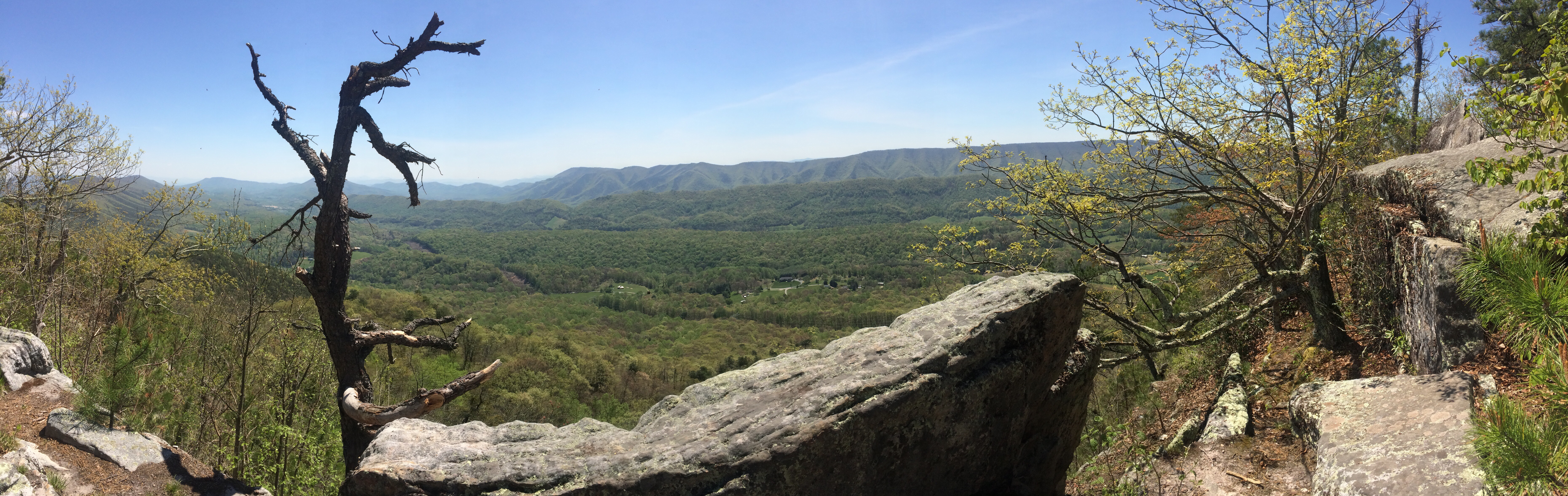
Virginia has a reputation for being a flat state on the AT. The high drop out rate here is attributed to the “Virginia Blues” as people get bored of the “Green Tunnel” as the budding trees cover up most of the views. Let me tell you though that my experiences so far are that Virginia is a really tough state, and the thirteen miles we hiked today were probably the roughest I’ve hiked so far!
What makes it so hard is partially expectation management. I was expecting Virginia to be easy and for us to be belting out consecutive 20+ mile days. Here I was struggling to do 13. I had also planned on being much further ahead in our hike at this point yet we seemed to be stuck in southern Virginia. I guess what I’m trying to say is this was the first point since the starting days in Georgia where I was really questioning if I was going to be able to compleat the AT.
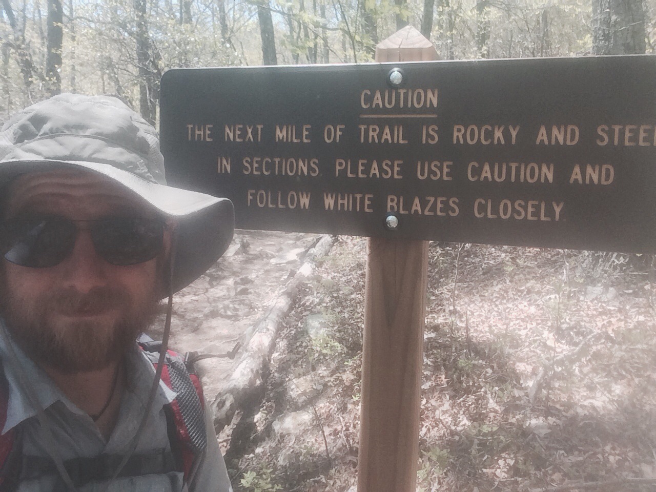
The first half of the hike today was fairly straightforward except for the fact that I gulped down 2 and 1/2 liters of water in the first three miles due to the heat and the amount of climbing we had to do. I’ve been taking magnesium supplements to keep my electrolytes up and I have some stuff to add to my water but I have to be careful since it makes me even more thirsty. Hanging out a Dragon’s tooth was fun since it was a huge stone outcropping with tons of climbing opportunities. Eating lunch on top of a stone monolith was certainly an enjoyable experience that’s for sure! I had used to go there in college, (as I said the rocks there are awesome), so I was expecting a fairly easy decent into Catawba Va. Little did I know the AT followed a different path down the mountain. Actually path would be too generous a term for that rocky cliff scramble. I wish I was joking but after 700 miles it was at this point where everyone’s trekking poles and shoes went to die. We were a broken and dehydrated group when we hit the base of that mountain only to find the water source there was completely polluted from the road.
I’m not exaggerating by much to say that a nearby gas station about saved my trip. We stumbled in there, bought several Gateraid containers, pounded them down, and then went back for ice cream. Resting outside, we were joined by another large group of hikers who were staying at a nearby hostel. We must have hung out there for nearly a hour recovering before heading back out. In a really nice gesture, the store clerk even refilled our water bottles for us.
We only had one more hill to climb before hitting Blacksburg road. Luckily Cliff, one of Owl and my old college roommates, was still in town and had the day off so he picked Owl, Wiki, Lorax and myself up and drove us to the Homeplace. The Homeplace was an all you can eat Southern homestyle restaurant we used to go to in college. I’m happy to say it was still delicious and we demolished several bowls of fried chicken and mashed potatoes before departing. More importantly it was good getting another chance to hang out with Cliff while we were in the area.
Refreshed and calorie fueled we headed back out to do some night hiking. It was at this point that Owl encountered the first rattlesnake of our trip. It was just a little baby but still … Did I mention today was rough? We pounded on the ground until the little bugger moved off and then let Wiki lead as he was up in rotation for snake detector. We stopped at the next shelter though as we all had enough hiking for the day. Luckily there were some nice camping spots and the location put us in a good spot to hit McAfee’s Knob early in the morning, but that’s a story for another day.