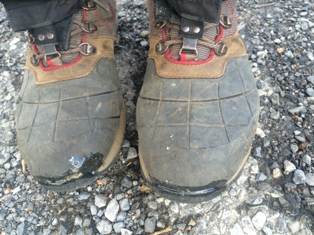
Author Archives: lakiw

Day 70: In which cows were encountered

Miles Hiked: 13.9
Miles Left: 1628.7
Ending Location: Knot Maul Branch Shelter

Well since I was already in town I of course had to stop by The Barn for an omelette. Once on the trail I ran into some trail magic two miles in which consisted of a several Gatorade bottles. Basically my morning was awesome. Side note, this was the first non~soda trail magic and it was greatly appreciated.

The last couple of miles of the day winded through private property. There were some great views over farmland which was very relaxing. Things got weird though when I came across a herd of cattle following the trail. It was on a cliff so I couldn’t pass them easily so I had to wait for them to mosey on. For those keeping tally, I’ve now been closer to being gored by a bull then mauled by a bear. During the last hill climb I was joined by Screaming Steven and we passed the time talking about encryption schemes which was a fun reminder of my day job. It surprises me how many computer science and engineering people are on the trail. I guess there’s something in common between working with machines and long distance hiking that attracts the same types of individuals.

Arriving at the shelter there weren’t any good camping spots but I made do since the shelter itself was rapidly filling up. I seem to be in the middle of a group of hikers that are all averaging about 25 miles a day but don’t carry tents. I’m sure they will blow by me shortly and things will get back to normal.

20140425-202825.jpg

20140425-202834.jpg

20140425-202844.jpg

20140425-202927.jpg

Day 69: In which backtracking occurs

Miles Hiked: 11.6
Miles Left: 542.7
Ending Location: US 81, Atkins VA, Rest Inn

Another plus about staying at Partnership shelter was that it was right next to the Mount Rodgers recreation center so in the morning there were heated bathrooms and outlets to plug your phone in, almost like real civilization! The sky had cleared up so it was great hiking weather and while there weren’t many views it was an interesting day. Back in college I had driven along I-81 looking up at those mountains more times than I could count so it was fun to be on the other side of that looking down.

I came across some crazy trail magic at a old schoolhouse museum where I met a couple restocking a hiker box with soda and fruit. They also had another box full of all the miscellaneous knick knacks hikers need like toothpaste and baby wipes. It turns out the husband’s great grandfather was the teacher there and their son had through hiked the AT last year. I congratulated him on continuing his family tradition of making delinquents like us AT hikers enjoy going to school.

Near the end of the day it was slow going. I ended up stopping at a railroad crossing while a train very slowly made its way along it, (hobo opportunity), and then took several stops afterwards to just enjoy the scenery. Also walking through Atkins I of course had to stop by “The Barn” restaurant for a burger. It was filling but considering all the good food I’ve been eating lately I have to say it wasn’t anything special. It’s kind of funny but I’ve actually managed to put a couple of pounds back on over the last week which was good.

I was still chasing Owl so after eating I headed back to the trail to put on a couple more miles but it was getting dark. Hiking through the forest at night hasn’t been a problem in the past since the trail really stands out, (it’s the part without any trees), but this section went through pastures which was problematic. Also I wanted to call my girlfriend and AT&T’s cell signal only extends about three feet from I-81 so after realizing continuing on was stupid I turned around and backtracked for about a mile and stayed at the Rest Inn. Normally I’d make a joke now about how I was roughing it but there were more bugs in that hotel than my tent. Also when I turned on the shower the toilet bubbled… All in all, I’d have to give that hotel a poor Yelp rating. But I was dry and full so I can’t complain too much.

20140425-184844.jpg

20140425-184908.jpg

20140425-184918.jpg

20140425-184941.jpg

20140425-185024.jpg

20140425-185044.jpg

20140425-185102.jpg

20140425-185140.jpg

20140425-185153.jpg

Day 68: Pizza at Partnership

Miles Hiked: 10.6
Miles Left: 1654.2
Ending Location: Partnership shelter

Today was a slow day. I slept in later than normal since, hey I didn’t make it in to camp till around midnight so I deserved it! Thunderstorms were predicted for later in the afternoon but I decided to hit the trail anyways and to stay aware of my surroundings in case the weather did turn nasty. The worst I had to deal with though was a constant misting of rain that would periodically turn into a light drizzle for a couple of minutes at a time. Still it was damp and hot so I was dragging. About three miles out I ran into a big contingent of hikers from the night before who were fed up with the rain and had made camp. They had a big bonfire going and it was tempting to join them but Partnership shelter was renowned for the fact that you can have pizza delivered and it had a shower. Those are great incentives to keep hiking!

Partnership shelter turned out to be pretty nice with a huge top section where several hikers had set up overlapping hammocks. Let me tell you, it was hilarious when in the middle of the night one of the guys on top tried to get out and ended up accidentally flipping his friend. Oh and the pizza…. Everyone ordered their own pie so we gorged ourselves on pepperoni slices all night long. The only downside was that the shower wasn’t open yet and you were not allowed to tent. All in all it was a good day which goes to show that pizza and a warm place to sleep can make just about any day good.

20140425-175830.jpg

I was much more happy in this picture compared to a couple minutes later when I realized that all the food was gone20140425-175859.jpg

20140425-175949.jpg

Pizza!20140425-180033.jpg

Spring!!!20140425-175920.jpg

20140425-180021.jpg

Day 67: Back to the trail

Miles Hiked: 12.5
Miles Left: 1664.8
Ending Location: Trimpi Shelter

First things first: Owl is feeling much better! After his symptoms persisted he stopped by an urgent care center where he was diagnosed with Giardia. They started him on a cocktail of drugs so now he just has to eat more and is banned from drinking alcohol for a while since that apparently reacts poorly with his medication. Both of us are perplexed how he got it considering with the two week incubation period we were double treating all our water when he was infected. I guess that’s just a hazard of living in the woods. Owl is now using an UV water purifier to make sure he kills all the nastiness. I considered it as well, but in the end I just bought a new filter for my pump.

Time really flew by in Blacksburg. That was doubly true once my girlfriend and Owl’s wife arrived. We reluctantly said goodby to them on Monday and headed back to the trail. Owl volunteered to drop me off at the trailhead where we originally hitched a ride and then return the rental car. The plan then was to meet up at Partnership shelter in two days time.

The weather couldn’t have been better and it was interesting hiking up Hurricane Mountain for the second time since it was fun trying to spot some of the half remembered landmarks such as the tree covered in Christmas ornaments. I stopped by the shelter to check the logbook and ended up stopping to chat with a couple new hikers I haven’t met before. Well I guess I’m the new hiker since after a week off the trail I’m in a completely different bubble.

Wanting to do more than four miles I pushed on to the next shelter. I briefly considered camping since there was no way I was going to make it before it turned dark but I decided to try night hiking again. Like last time it turned out to be a lot of fun. My favorite moment was stopping for dinner and reading my kindle under the stars. I also ended up chasing a rabbit down the trail for quite a ways as it would keep pace hopping ahead of me. Maybe it thought the coyotes would eat me first…

Arriving at the shelter I found it absolutely packed. Not only was the shelter full but there were tents everywhere. I later discovered that a bunch of people stayed in town for Easter weekend so several bubbles had merged. I ended setting up my tent a short ways away from the shelter, (luckily there were tons of good camping spots), and promptly fell asleep.

20140425-175650.jpg

Day 60: Two Months!

Miles Hiked: 0
Miles Left: 1677.2
Ending Location: VA 603 Road Crossing, Comfort Inn in Atkins VA

Just a quick update. As I said in the previous post Owl is feeling much better and I’m still healthy. We’ve now been officially hiking for two months so I felt that was worth a journal entry! As for today, the most exciting thing was I hiked a half mile to the dollar general ;p Tomorrow we’re picking up a rental car and are relocating to Blacksburg so that’ll be fun. Mostly though I’m just excited I’ll be seeing my girlfriend in a couple of days. We have a lot to catch up on, especially since she just got a new job, (since she’s awesome)!

So that’s a longer way of saying, two months down, four to go, and I’ll start blogging again next week. In the meantime, I uploaded a bunch of pictures so enjoy!

20140415-012650.jpg

Day 59: Not noro but not good

Miles Hiked: -3.3
Miles Left: 1677.2
Ending Location: VA 603 Road Crossing, Comfort Inn in Atkins VA

Owl got very sick in the middle of the night. I won’t go into graphic detail but it involved both “ends” and he had a fever. I didn’t realize what was going on until that morning when he told me, so our priority then became how to get him off that mountain and into a hotel.

Owl popped a bunch of Imodium to stop everything up and we hiked back the way we came to the road crossing. While it was slow going, I’d like to point out that we still hiked faster than we did back in Georgia. Luckily Owl’s stomach held out for that and the shuttle ride into town. It must have been absolutely awful for him but we made it.

The Comfort Inn was nice and it was right by a truck stop so I could pick up a few things for Owl. We stayed in separate rooms since we have no idea how contagious what he has is. For hikers reading this blog, I’d recommend skipping Hurricane shelter just to be safe. Moving ahead to a day later, Owl is feeling much better and can eat real food again so it probably isn’t Norovirus but it isn’t good. He’s in high spirits but please send warm thoughts his way. His blog, brianhikeshome.com does have comments. Also I haven’t been pushing this but he’s participating in Hike for Mental Health which is a really good charity and if you donate you can leave comments as well….

Our plan right now is to take a week off the trail. In a weird way the timing was fortunate as we were already planning on taking Thursday- Monday off as my girlfriend and Owl’s wife are going to be meeting us in Blacksburg. This means Owl should be healthy for that but also has a long time to recuperate before hitting the trail.

So in conclusion we’re both doing as well as can be expected, and we’re both going to be finishing this hike, but we’ll be taking a break for a week. I’m not sure if I’ll update this journal or not since “Watched Netflix all day” doesn’t make for riveting reading but we should be on the trail again starting next Tuesday.

Side note, found this hat abandoned in a shelter. Thought it was Grease Spot’s so I’ve been carrying it and washed it in town. It’s not his so I might end up using it. #Styling #CoolStoryBro20140415-011901.jpg

Day 58: The Proclaimers song, on repeat, all day long

Miles Hiked: 16.0
Miles Left: 1673.9
Ending Location: Hurricane Mountain Shelter

Well I started the morning out by hugging a wild pony so my day was basically awesome.

A pregnant mare had somehow figured out how to make it into the shelter area and was being very sweet with everyone. She did love licking the salt off people’s legs though so I was glad I had long pants on. She wasn’t the only pony I saw but she was the only one I petted as we passed through a herd of them later on. As for the hiking, we spent most of the day walking along the Grayson Highlands which had a very Colorado feel with exposed rock boulders and lots of plains. There was also a cool “cave” we passed through called Fatman’s Squeeze which was interesting to navigate with my pack on. Reading the history of the place, apparently it used to be a major cattle farming area before the forest service bought it up. Realizing that they couldn’t keep the balds tree free without grazing animals they decided to introduce ponies in the 1960s figuring that would keep vegetation down and attract tourists. They were right. I mean, who doesn’t like ponies?!

The other accomplishment today was Owl and I have now officially hiked over 500 miles of the AT! The milestone occurred just before Wise shelter so a bunch of other hikers and us stopped there for a bit to celebrate. The trail maintainers really need to put up a sign to mark mile 500 as that would make a great photo. Also, if you are doing the math, don’t worry that we’ve used 33% of our time to hike 25% of the trail. Our plan was always to start slow. Heck, we used to consider a 9 mile day a stretch. With 16 miles being the new “normal” for us we’re still on schedule to finish up in six months.

We ended the day at Hurricane shelter. There was no tent sites around it but Owl set his up right by the picnic table while I just crashed in the shelter itself. It was a brand new shelter built last year so it was nice but the mice haven’t wasted any time moving in. I had to chase a couple away from my food bag while I was having dinner and they were scurrying all over throughout the night.

20140415-011326.jpg

20140415-011343.jpg

20140415-011411.jpg

20140415-011502.jpg

20140415-011616.jpg

20140415-011651.jpg

20140415-011727.jpg

20140415-011736.jpg

20140415-011750.jpg

20140415-011817.jpg

20140415-012305.jpg

Day 57: Mt Rodgers

Miles Hiked: 12.2
Miles Left: 1689.9
Ending Location: Thomas Knob Shelter

Today marked two accomplishments. We summated Mount Rodgers which was the highest point in Virginia. We also entered the Grayson Highlands which have wild ponies running through them. I won’t lie in the fact that the second part was the one that interested me the most. Every pasture we hiked through I was looking for a pony to hug. Little did I know that the ponies don’t show up till past Thomas Knob Shelter.

Despite that it was still a good day. We all had lunch at buzzard rock which was appropriately named as all sorts of hawks and vultures were using the updraft to soar into the sky. Nearby there was an amazing water source which we used to rinse some of the salt and grime off ourselves. I split off from Owl at the end of the day to take the side trail to the top of Mt Rodgers. There’s no view at the top, just a cool stump surrounded by pines, but I wanted to check that peak off my bucket list. I later arrived at the shelter to find it filled by Boy Scouts. They offered to make space but I decided to camp instead. Camping was interesting since there was the possibility that we might be woken up by horses. Despite that the only horse I saw was way off in the distance and with the exception if the rain and a fairly strong wind it was an uneventful night

20140415-010851.jpg

20140415-010927.jpg

20140415-010954.jpg

20140415-011030.jpg

Highest point in Virginia!20140415-011121.jpg

20140415-011110.jpg

Day 56: in which a lazy day is had

Miles Hiked: 6.4
Miles Left: 1702.1
Ending Location: Lost Mountain Shelter

Today was a lazy day. There’s no other way to put it. With me only having to hike six miles I slept in without guilt. Upon waking I found Batman who also had the same plan as me and had hiked out of town late to break away from the pull Damascus imparts on you. It’s really easy to get sucked into a town and waste a lot of time there.

The hike itself was fairly easy. The only annoying part was that the AT and the Creeper trail diverge a lot even though they both end up in the same place. While the Creeper trail is all one big gentle slope winding along a scenic river, the AT instead decides to make its way up and down every tree covered mountain instead. It’s tough to know that you’re walking more miles, harder miles, and less scenic miles than another trail that you just rode down the day before.

I arrived at camp early so after pitching my tent, filtering water, and getting settled in I took a rare afternoon nap. I was briefly woken up around four as Owl arrived and tried to pretend to be a bear, but then fell back asleep. Even after waking up for good I still lounged around till around seven updating my journal. Basically it was a very pleasant day. If I only could get away with hiking six miles every day! About the only other thing of note is the fact that grasshoppers look like giant spiders when you find them in your tent at night. That was not a fun fact to learn.

20140415-010444.jpg

20140415-010522.jpg

Not a spider, but it sure looked like one!20140415-010538.jpg

Day 55: Riding the Creeper trail, and a zero day is narrowly avoided

Miles Hiked: 9.2
Miles Left: 1708.5
Ending Location: Sanders Shelter

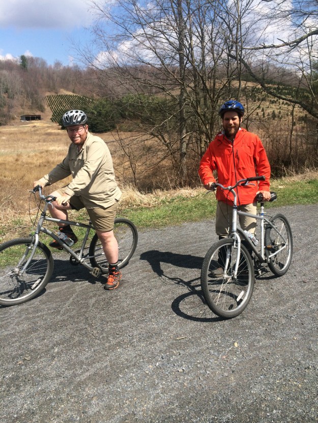
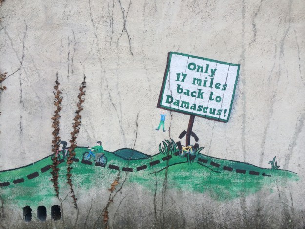
One of the things I really wanted to do in town was ride the Creeper Trail. No this isn’t some joke name for the AT like Young Beard and Sunshine thought, (though I can see how that might be appropriate). It’s actually a semi-well known section of former train tracks converted into a trail, running from White Top mountain through Damascus. The trail is almost all downhill and several shops in town will rent you a bicycle and drop you off at the top of it. After hiking nearly 22 miles the day before, cruising 17 miles downhill on a bike sounded glorious.

Unfortunately due to the weather the earliest drop off we could arrange was at 2pm so Owl and I had some time to kill. We started off at the Post Office mailing home our excess gear. In a bit of nostalgic poor decision making I decided to keep my Kindle. I had rediscovered it the night before when my phone was charging and had an absolute wonderful time reading it. I was reminded of a story my Dad had when he was a child and his parents sold his rocking horse. So looks like I’ll be carting it over a few more mountains.

After that it was on to grocery shopping for supplies. We’re expecting this next stretch to take five days which means a lot of food with the way we’ve been eating. Still when I got back to the hostel I found out once again that I had bought way more than I needed. Oh well, at least I won’t starve. Supposedly as we get further into Virginia we’ll be able to resupply every other day or so which will really help with lightening our load. Both of us need to get better at getting into town, buying food, and then getting out quickly though.

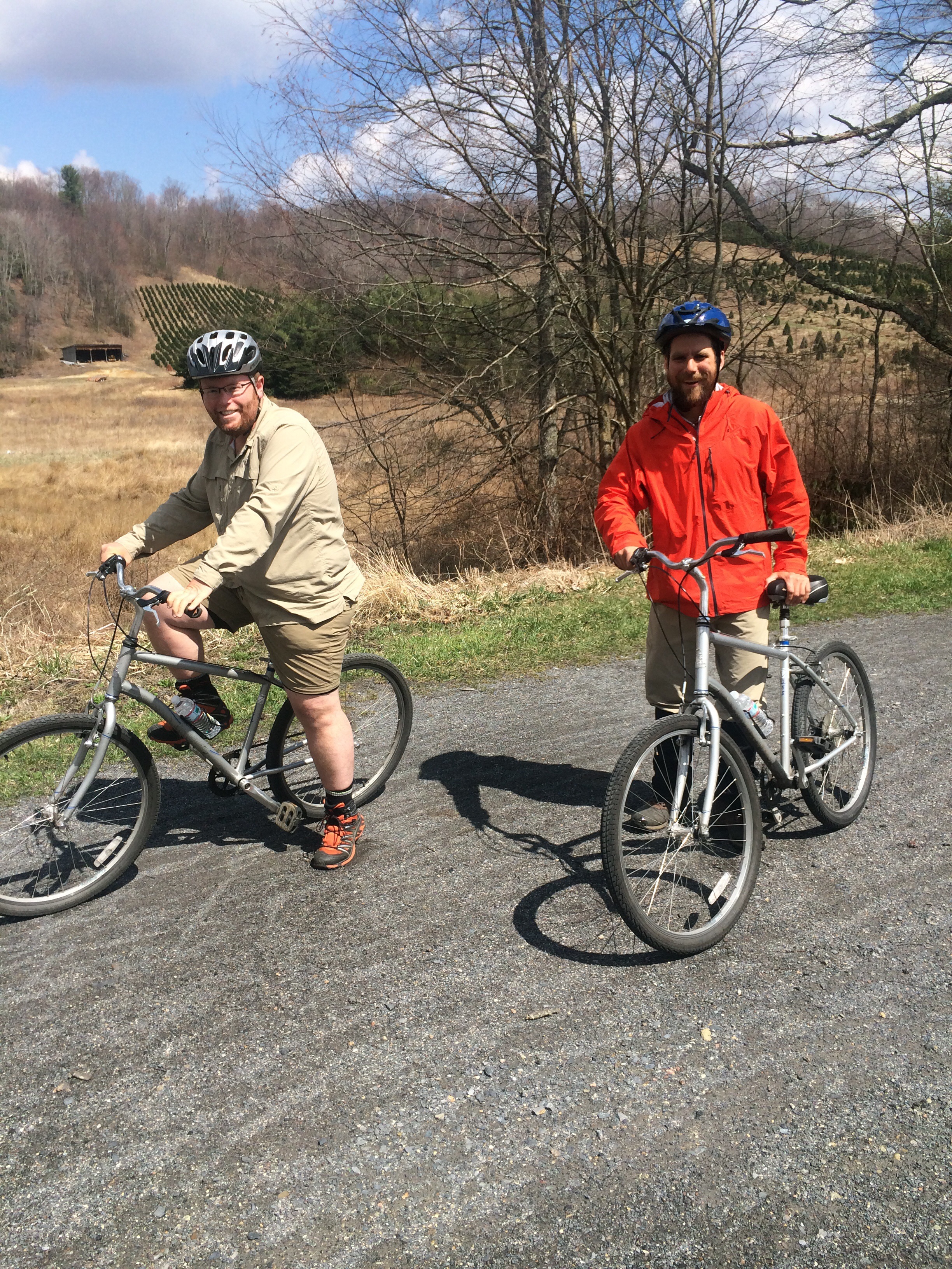
Slightly before two, Owl, Vegemite, and I showed up at the bike rental place to ride the Creeper trail. I have to say, they certainly didn’t waste time with safety instructions as we had to specifically ask for helmets and they seemed shocked we would want such a thing. Then it was a long winding van ride to the top where I tried not to get carsick and Vegemite forgot his phone in the passenger seat. Oh man, the bike ride was so worth it though. The first 10 minutes were terrifying but after that it was pure fun. The best part was that a section of the AT currently runs along the Creeper trail since a bridge was washed out about a year ago. Seeing your fellow through hikers trudging up the mountain with full packs while you blast past them in a bike with a smile on your face is an experience you have to have. More importantly though, riding the Creeper trail helped remind me that I am on vacation and am supposed to be having fun vs just pounding out the miles north every day. When I think back to my town visits, such as going to the aquarium in Gatlinberg, I’m realizing I need to spend more time doing things like this when I get back home after completing the AT. Oh another funny fact about the Creeper trail. On the few uphill, (ok flat…), sections of the trail I discovered the leg muscles you build while hiking have absolutely nothing to do with the muscles you need for biking. It was actually kind of embarrassing how out of shape I was for that activity.

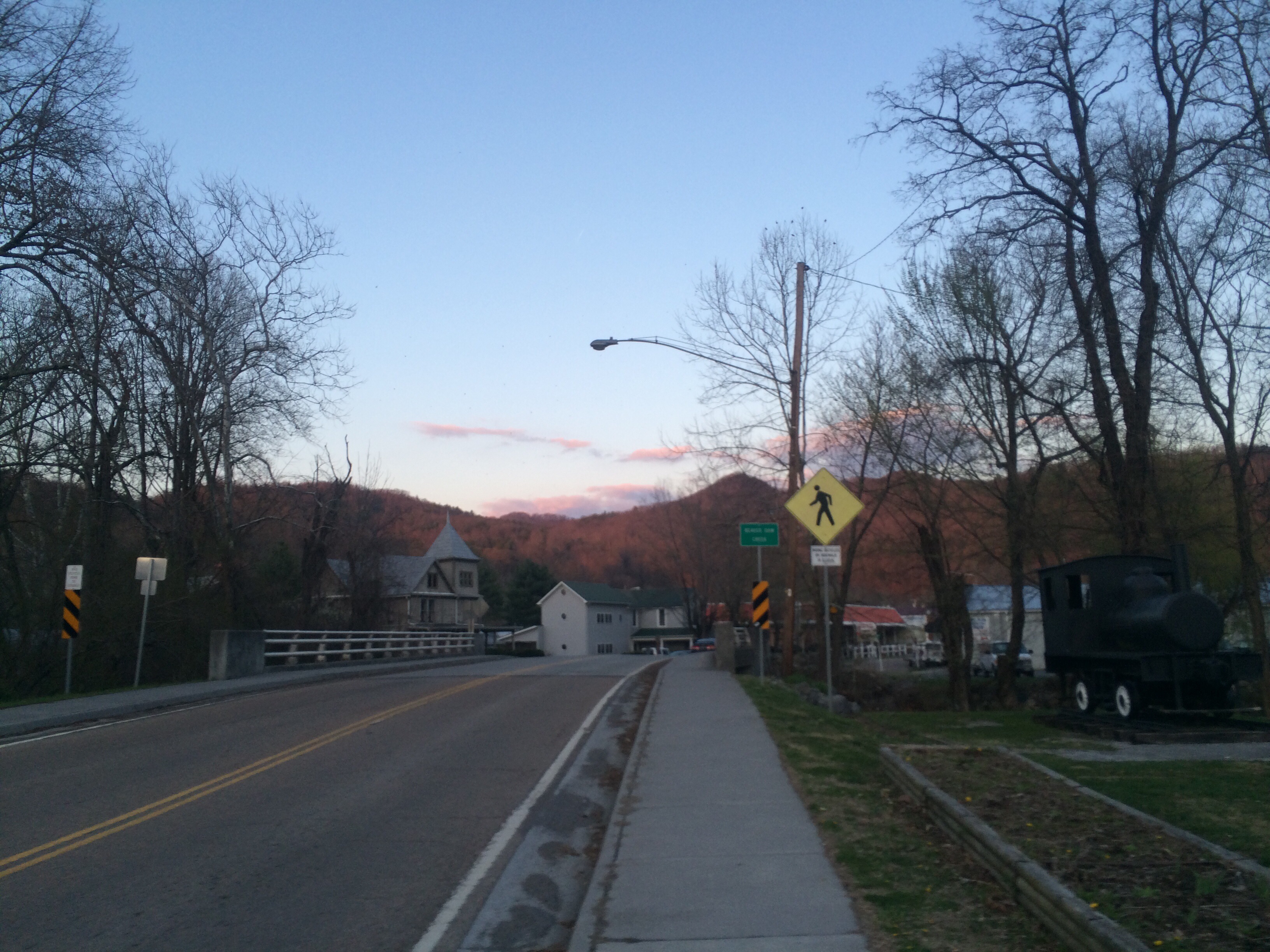
After 17 miles of “off-road mountain biking” we of course needed to grab BBQ and a beer. Then it was back to the Woodchuck hostel to pack all my stuff up. My original plan was to hike a couple of miles and then tent, but with the late start time for biking and then dinner that plan had changed into moving to the cheaper Methodist run hostel down the street instead. I hung around Woodchuck for a bit though reading my Kindle some more, chatting with the owner, and recharging my phone. The sun was setting as I was leaving and the colors in the sky were gorgeous. It was absolutely beautiful weather so when I ran into Young Beard and Sunshine and they asked me if I was heading out I made a spur of the moment decision and said yes! That was a good choice as it turned into one of my favorite hiking experiences so far. As I was leaving town I was treated like a rock star. People think poor planning is hardcore! The trail was well maintained and the blazes were plentiful so I had no problems hiking in the moonlight with my headlamp. More importantly, it felt like I had the entire trail to myself. I turned my music on, both to rock out and serve as a more fun way to warn bears of my presence than bells, and was able to crank out about ten miles while having a blast. Once at the shelter I briefly considered pushing on another six miles to the next shelter where Owl and I had planned on meeting the next day, but opted not to push my luck and set up camp instead. As the weather continues to get warmer I think I’ll do more night hiking in the future.

Side note: If you look at the group shot from yesterday you’ll notice that Youngbeard didn’t bother to put down the burger he was eating with his *broken* hand. That’s hiker hunger!
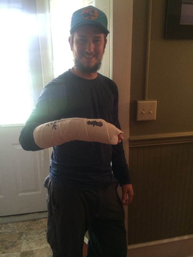
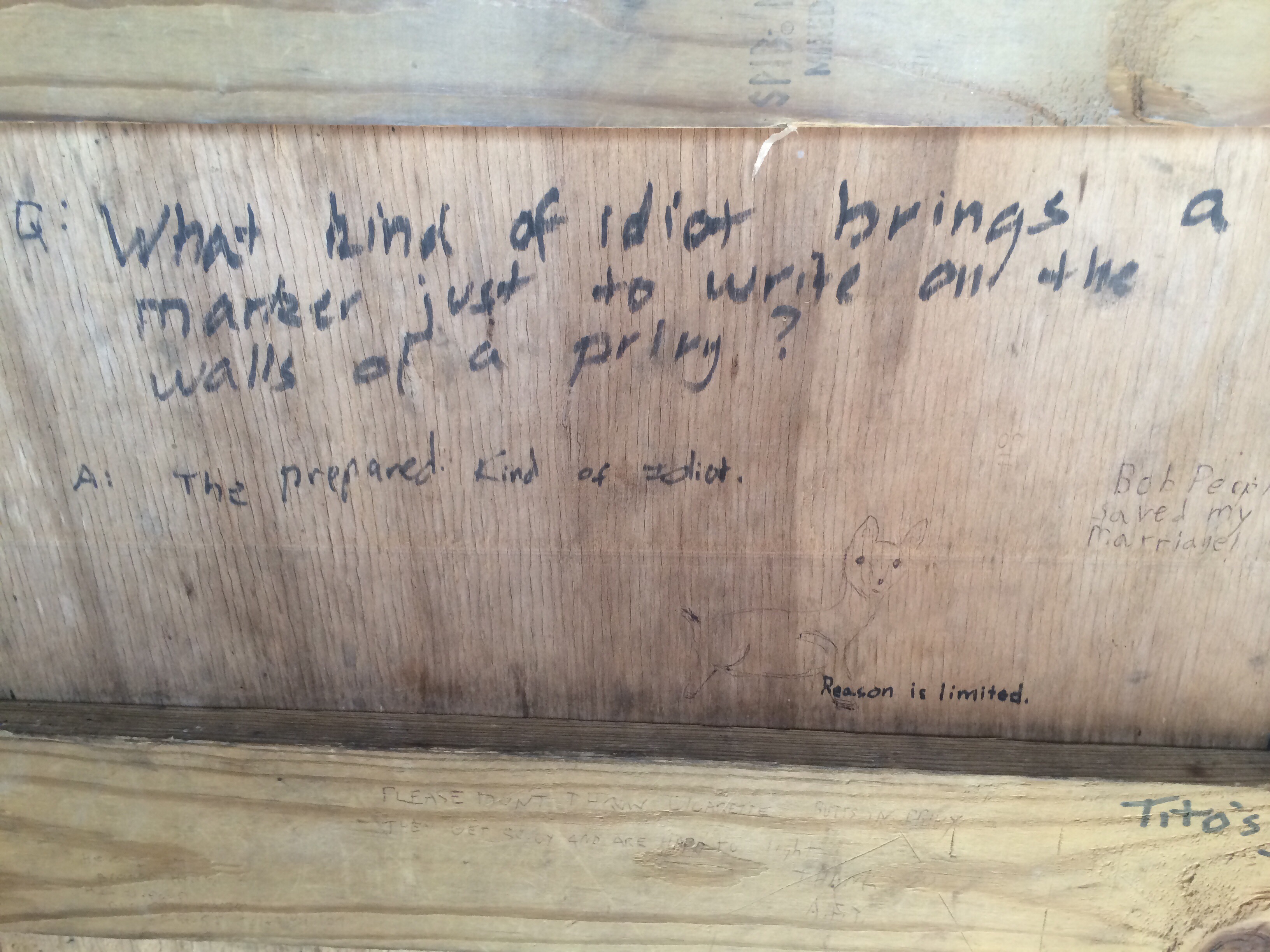
20140415-005407.jpg

20140415-005438.jpg

20140415-005453.jpg

Safety first!20140415-005515.jpg

20140415-005540.jpg

20140415-005606.jpg

20140415-005700.jpg