Author Archives: lakiw

Day 15: In which a ride is hitched and finally have BBQ

Miles Hiked: 3.8
Miles Left: 2075.5
Ending Location: Winding Stair Gap, and the Microtel in a Franklin, NC

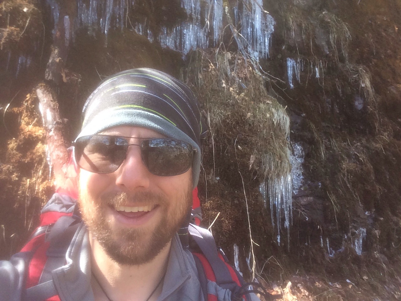
You hear people say all the time, “It’s not the heat, it’s the humidity”. The same applies to the cold. Everyone’s tent this morning was covered in ice, but it didn’t rain. The forecast said it wasn’t supposed to get much below freezing this morning but I’m pretty sure that was a lie as the water I had kept in my sleeping bag started freezing immediately after I took it out. It was disheartening when putting away stuff, seeing your gloves covered in white ice flecks, and realizing that was your condensed breath. I joked with B that if he had kept his single walled tent he would have woken up looking like Han Solo frozen in carbonite.

Like the rest of the trip so far, (knock on wood), once the sun came out it turned into a beautiful day. It was a short hike until we came to the US 64 highway crossing. Most of the shuttle services into town haven’t started this early in the season so B and I decided to try and hitchhike. As luck would have it the first pickup truck that came by pulled over. The driver said, in all seriousness, anyone with a beard like B’s had to be trustworthy. So B got in the cab and I hopped in back with our packs, and away we went. No weirdness at all though there was a pair of plastic vampire fangs lying in the bed of the truck. Maybe he was a larper?

We were dropped of by the BBQ place in town since the driver didn’t know where our hotel was. We decided to walk to the hotel and shower before eating because … well you can imagine. That turned out to be a good idea because on the way there we stopped by a DQ for blizzards, (hey we needed something to tide us over), and while having a conversation with a nice couple in line I realized exactly how ripe I was. They didn’t say anything but I almost wanted to apologize for making their dining experience worse.

Once showered we made our way back to the BBQ place for lunch. It was good. Nuff said. We then stopped by Three Eagle Outfitters to pick up supplies and coffee. They did not have pumpkin spice latte like they promised B on their Facebook site and I was very impressed by his calm response and the fact that he didn’t burn that place to the ground. The people were nice and helpful though. Both B and I picked up some food and B purchased a new ground mattress for his back. We also found out they can ship stuff home so we made a second trip there shortly thereafter so B could send back his old ground mattress, his SPOT, and his kindle, (neither of us has had a chance to read but I can’t bear to part with mine yet). We also got our AT passports stamped. Apparently we were the first hikers to do that there.

Then it was laundry time. Unfortunately our hotel didn’t have guest laundry facilities so B and I had to hike along the highway with our dirty clothes bundled up like hobos to the nearest laundromat. A kind former through hiker, (Two Healers), stopped and offered us a lift for the last bit of it, and then it was two hours chatting with other hikers and updating my journal.

Side note: We all agree, it’s really annoying when someone who drives everywhere gives directions to someone without a car and refers to something as “close”.

B and I finished off the day at Fatz cafe, a local burger joint that *really* supports the high school football team. We both had a to of stuff to do, (like packing) but I spent the remainder of the night making phone calls now that I had cell service. We’re not going to be taking a zero day so we’ll be back on the trail again tomorrow.

20140307-214422.jpg

20140307-214515.jpg

Day 14: In which Matt sees his shadow and goes back to bed

Miles Hiked: 12.1
Miles Left: 2079.3
Ending Location: Rock Gap Shelter

I’m not sure if it was 15 degrees this morning like the weather report said, but OMG was it cold. Actually woke up around 7am when everyone else was stirring and my sleeping bag was the perfect temperature. Now admittedly I was wearing all my cold weather gear, (hello down booties), but it’s nice to know I can shelter in place if the weather turns bad. Now getting moving is a different story. After about 15 minutes of psyching myself up I left my tent and went to use the facilities and grab breakfast. About 15 minutes after that I beat a hasty retreat back to my sleeping bag because I was loosing feeling in my fingers and toes.

Now if it was critical for us to get moving I do have chemical hand and foot warmers, but I’m trying to save them for the Smokies. I also had told B previously that it’d be a late start so I spent the next two plus hours trying to warm up, slowly changing into my hiking clothes, and packing up everything but my tent and sleeping bag.

By the time I started stowing the last of my stuff it was still cold but bearable. It’s amazing how frustrating it can be to stuff things into bags when your fingers are numb. Long story short we didn’t get on the trail till around 10:30, (may have been closer to 11).

The actual hike was a lot of fun. We made great time despite the late start, and it included some really cool cliff walking. At one point we were actually on an overhang and the view was spectacular. The highlight though was Albert mountain. The blue blaze bypass trail around it is recognized by the AT as an “official” part of the trail because the climb up Albert mountain has been deemed too treacherous during inclement weather. It was awesome! Basically it was a combination scramble and rock climb all the way to the top … with a 40 pound pack. In all seriousness that has been my favorite part of the trail so far. Also, you know you are an AT hiker when you ask yourself, “Is this a stream or the trail”, and the you go “Eh” and keep on hiking.

The shelter at the end of the day was a huge disappointment. No bear cables, the privy was subpar, (less said the better), the trail journal was chewed up by mice, and more importantly almost no tent sites. The actual shelter was full up so I had to set my tent on an incline by the campfire. A couple of weekend hikers stayed up half the night throwing more wood on the fire so I had to deal with the smoke and fear that a stray ember would turn my tent into a blazing bunch if melted plastic. Not ideal, but of course I couldn’t bring myself to ask them to please go to bed. Lesson learned, don’t tent near the fire even if the other places are less level.

20140307-214322.jpg

Day 13: Still Winter

Miles Hiked: 12.5
Miles Left: 2092.4
Ending Location: Carter Gap Shelter

I’m sure this is getting old starting my entries this way, but it was really cold this morning. Having to break camp when it’s below freezing is my least favorite part of hiking the AT so far.

Upon leaving camp B an I realized we were going the wrong way. Turning around I ended up slipping on an icy plank spanning a creak and stepped right in the water. Let’s hear it for waterproof boots!

For the first half of the morning B was a bit out of it because he had taken muscle relaxers for his back. He likened it to driving drunk since he knew where he wanted to go, but getting there was a bit tricky. They wore off soon enough and he reported that he felt fine. Sleeping on the ground has been giving him problems, but unfortunately there’s not many other options. He may end up picking up another air mattress at the next resupply which has a full fledged outfitters shop.

The hike itself was long but fairly uneventful. I wore my coat until around 11 which should tell you it was pretty cold. We had lunch on top of Indian mountain and were treated to a spectacular view. Most of the terrain today was either flat or downhill, (with the exception of that one mountain), so we were really able to put on the miles. One cool thing was the variety of plant life, (or lack of it), we saw. Each couple of miles were very different from the last.

We rolled into camp around five and the temperature was dropping fast. Most of our original bubble was here which was fun, but between setting up my tent, eating dinner, and getting ready for bed I didn’t have much time to socialize. Winter really is coming and there’s a good chance the temperature could drop to around 15 degrees tonight. I already told B that tomorrow will be a slow start…

20140307-214232.jpg

Day 12: Hello North Carolina!

Miles Hiked: 7.3
Miles Left: 2103.9
Ending Location: Muskrat Creek Shelter

Woke up this morning to light hail and rain. I ended up staying in my tent until it stopped around 7:30ish. It wasn’t that cold though which was a plus. A common theme lately has been the days being nice but the nights being freezing. Apparently it might start dropping into the low teens in the near future so I’m certainly glad I went with a zero degree bag. Luckily though it hasn’t stayed below freezing for long which makes life a lot easier. For example finding water in a liquid form hasn’t been a problem yet.

Leaving camp turned out to be more difficult than expected since it was a distance from the trail and there were a ton of surrounding campsites. Basically it was a maze and we all got turned around a bit before we saw our first white blaze of the day.

The big event of the hike today was we finally left Georgia and are now in North Carolina! Everyone celebrated a bit when crossing the boarder. I can see why the boarder was where it was since it marked the entrance to a fairly significant mountain range. Long story short, there was a whole lot of “up” today. I heard it said before that North Carolina doesn’t believe in evolution or switchbacks, and I’ll attest to the second with the trail going straight up those mountains. The highlight for me though was there was one turn off that I spotted that ended up having the most spectacular view so far. It also had a great climbing tree so I was happy.

We rolled in to the shelter around 3:30pm. The next shelter was about six miles away and campsites were sparse so we decided to stay. The North Carolina shelters are much less well maintained than the ones in Georgia. I guess that’s because much less people actually make it this far ;p

Our original hiking bubble is starting to break up with some of the people testing their legs and aiming for higher millage days. We’ve also been joined by several hikers from the bubble behind us. I’m now seeing how cool the shelter logs are now that I’m seeing familiar names in them.

I ended up grabbing a quick nap after setting up my tent which was wonderful. After finishing my dinner, (cheese, pepperoni, and dried fruit), I went back to my tent to get fully caught up with my journal. As I’m writing this I’m listening to the owls hoot nearby. Today was a good day.

20140307-213238.jpg

20140307-213443.jpg

20140307-213513.jpg

20140307-213549.jpg

20140307-214138.jpg

Day 11: Deja-vu no moe!

Miles Hiked: 4.5
Miles Left: 2111.2
Ending Location: Plumorchard Gap Shelter

Brian and I woke up early in the morning, availed ourselves of the breakfast buffet and clean showers and then caught a ride back to Dicks Creek gap to resume hiking. On the way there our shuttle driver stopped by Subway so Brian and I each bought a footlong sub and strapped it to the back of our packs.

Thus prepared we headed into the great unknown. Last year our trip ended at Dick’s Creek so everything from now until we hit Vermont will be brand new to us. It was an absolute gorgeous day to be hiking and it felt good to be back outside. The only notable event while hiking was we saw a bunch of smoke off in the distance. It made me realize I didn’t even have wildfires on my threat radar so that gave me something to think about as we walked.

Since it was a low mileage day we arrived at the shelter around 1pm. B and I debated moving on but it was by far the nicest shelter we’ve seen and there was great tenting locations so we stayed. Giggles, (now known as Sunshine), and Julian, (now known as young beard), stopped by briefly. B played the part of the hero by finding a major problem with the rigging of Sunshine’s pack. Once it was fixed she couldn’t believe how much more comfortable it was.

There’s been a bit of renaming going on as people try out their trail names. Zen Master will likely end up being “Three Miles” since according to his wife that’s always his answer when she asks him how much further they have to go. Neither B or I have trail names yet but I expect we’ll get something before the Smokies.

The time flew by as most of our original group stayed there so we spent the next couple hours swapping stories. The firepit had a grill so B wowed everyone with a pizza quesadilla he cooked up on it. I on the other hand just finished up my sub which felt like cheating but I figure was a very Cambridge thing to do.

Almost all of us camped for the night so Andrew, (the Australian) had the entire three story shelter to himself. I on the other hand spent the time in my tent trying to catch up on my journal since I had completely neglected it in town. Hey that Netflix wasn’t going to watch itself!

Around midnight we were all woken up by the sound of a coyote howling in the distance. It was actually more neat then scary. I figured they’d eat Andrew first ;p That explains all of the dead squirrel fur and tails over the trail.

After that it was back to sleep. I am happy to be hiking again which was a welcome surprise. I had expected that I would miss all the creature comforts of civilization more once I had a taste of it again.

20140307-212934.jpg

Day 10: In which I drop an 0-day

Miles Hiked: 0
Miles Left: 2115.7
Ending Location: Still at the Holiday Inn

So first off, the term 0-day now has such a different meaning than it used to.

B and I decided to spend the day in Hiawassee since we had agreed to meet everyone for lunch and had to resupply. Also the time off the trail was certainly welcome after a 11 mile day yesterday.

We started the morning by planning what our hiking schedule would be like since we needed to know how much food to buy. Well, we actually started it eating the excellent breakfast at this hotel. Biscuits and gravy, bacon, hot muffins… They even had a cool pancake machine! After breakfast though we got right to planning. We also had to figure out when we’d require the care package containing food and snowshoes to arrive for us at Fontana Dam. FYI, Fontana Dam is the last resupply spot before we enter the Smokies. I ended up sending an overly verbose, (I know, from reading this journal that’ll be a shock), email to Liz and Theresa talking about what we’d need and they both went ahead and took care of it that day. So if B and I get through this with all our fingers and toes intact you’ll have them to thank.

By the time we were finished it was time for lunch. Everyone met downstairs and we all walked over together to another buffet restaurant. The type of food reminded me of Homeplace, which is an establishment any Virginia Tech grad is very familiar with. Fried chicken, fried okra, mashed potatoes , stuffing, etc. Basically good food and great company, (but creepy place. Way too many scary dolls). It was funny seeing some of the younger hikers keep coming back from the buffet with arms full of desserts.

After that B and I went to Ingles to stock up on food. We chose to go to a grocery store because the “hiking” store was closed on Sunday which meant we couldn’t buy our standard dehydrated meals. Also, after listening to Wild Trout and Fabio the night before we both wanted to experiment with a different diet. When looking for food we had a couple goals:
1) Lightweight, since we have to carry it
2) Compact, since it has to fit in our packs
3) Durable, since it will be smushed/ crushed and non-refrigerated, (though refrigeration isn’t a huge deal since it is cold half of the time)
4) High in calories
5) High in protein
6) High in fiber

I also made sure I used a basket vs shopping cart so I wouldn’t buy too much. I failed. Basically there’s no worries about me going hungry in the near future. It was a lot of fun though and I’m basically treating this whole next week as a science experiment to see what works and what doesn’t when it comes to food on the trail.

Grocery shopping took approximately three hours. After that it was back to the hotel to complain that we bought too much food, and for me to start catching up on the new season of House of Cards on Netflix. Ah civilization.

That night we went back to Ingles to grab dinner from the salad bar. Both of us were done for a while with buffets since we really weren’t that hungry. Also, the constant eating was having some unfortunate side effects that are not conducive to hiking all day in the woods.

So that’s what an 0 day is like in Hiawassee.

20140307-212743.jpg

Day 9: In which a town is reached

Miles Hiked: 11
Miles Left: 2115.7
Ending Location: Dick’s Creek Gap / Holiday Inn at Hiawassee

I did not want to get out of bed this morning and it had nothing to do with the scandalous act of staying up till 7:30 the night before. A number of people had gotten up to see the sunrise but I looked through the mesh of my tent and saw the frost heaves and decided to sleep in. It was probably in the 20’s since when I finally did get up I saw that several trees had sap that froze and burst out of them.

Of course it was this morning that B had woken up early and was ready to go. He had his pack on even before I had finished loading all my gear. Rather then telling him to start without me I shoved the last of my stuff in my bag and started out with him. About 20 minutes into our hike I wised up and told him to go ahead while I got everything sorted out. I’ll remember that for the next time I get a slow start.

Once the sun had a chance to warm everything up it actually turned into a pretty nice hiking day. With it being a Saturday we saw a lot of weekend backpackers on the trail. You could tell they weren’t through hikers since they were going the other direction; Heading from civilization into the wilderness. All of us on the other hand were focused on getting into town. B and my original plan was to only hike 8 miles to Deep Gap shelter and then the next day catch an early ride into town. Anyone who knows us though would realize we’d throw that plan out immediately and hike the extra miles so we could enjoy a hot shower and a room that stayed above freezing.

The one notable landmark on the trail was Kelly’s Knob which is a very steep mountain. It was just as brutal this time as last. Kelly’s isn’t the tallest mountain, but there are no switchbacks. Also it’s mean. The way the mountain reveals itself tricks you into thinking you are near the top, only to surprise you with even more “up”.

The only other mountain of note was Powell Mountain. Luckily that one was mostly all “down”, though it does have about a half mile of unexpected “up” at the end. We called for a ride to pick us up at five since cell phone reception at Dick’s Creek Gap, (which US 76 runs through), can be spotty. All the other hikers decided to try their hands, (ok their thumbs), at hitchhiking. When B and I got to the road everyone was clustered around the parking lot wondering what to do. Giggles was valiantly trying to flag down a car but every time someone would slow down for her they would see everyone else and speed up again.

Julian actually managed to get signal and told our shuttle driver about our situation so she had her friend/wife, (didn’t ask), drive out as well so they could pick everyone up. For the record, before our drivers showed up Giggles and Julian did manage to hitch a ride into town,

The Holiday Inn was wonderful. It wasn’t much more than the cut price places and it included laundry, cookies, and a great breakfast. Also it’s a Holiday Inn…

After B and I checked in we immediately took turns with the shower to make ourselves semi presentable and then headed out for dinner. The pizza place that had been recommended to us ended up being farther than we expected but without packs on it wasn’t too bad of a hike. The place had a buffet that we took full advantage of but unfortunately the pizza itself was not all that good. I don’t know if I’m just a pizza snob or if everyone who raved about it were just starving.

Once back at our hotel room we did laundry. I had planned ahead and not worn my second pair of pants on the trail since Neel’s Gap so I didn’t have to wear my, (ok, Theresa’s), rain pants while my clothes were in the machine. I saw a lot of other hikers walking around in rain gear too during my stay there. I do wonder what the other guests thought of us.

Shortly afterwards the last two southbound AT hikers, Wild Trout and Fabio, stopped by our room to talk to B. They gave us an absolute to of advice on what to expect, but by the time they left, (1am), I was exhausted. As a side note they hiked 21 miles the next day. The high points they gave us were to avoid shelters with homeless people in them, eat lots and lots (and lots) of protein, and try to avoid being jerks who are just rushing to finish at the end, which apparently is a common fate of many north-bounders.

Then it was time to sleep in a real bed. Woho!

20140307-212847.jpg

Day 8: A whole lot of up

Miles Hiked: 8.1
Miles Left: 2126.7
Ending Location: Tray Mountain shelter

Normally thunderstorms are awe inspiring. Try sleeping through one in a tent at the top of a mountain! It was pouring, the wind was gusting and the thunder was booming. Luckily my tent held up so it was tons of fun.

Waking up on the morning was not. My sleeping bag was the perfect temperature, everything was damp, and the temperature had plummeted. Luckily once we started hiking I started to warm up, and soon enough the sun came out and it got downright hot.

Today was the most elevation change we’ll see in Georgia with us going down Blue mountain, up and down Rocky Mountain, and ending up on top of Tray mountain. Of course we’re nearly done with Georgia so there’s a lot more big elevation days coming up! We came upon a group of through hikers at the old cheese factory where we tented last year. They had started Feb 2nd and were not going anywhere fast.

That was at the base of Tray mountain. At the top of it we could see skyscrapers way in the distance. There was a lot of debate but we suspect that was Atlanta since we couldn’t think of another city with such a profile. If so, that’s impressive since we were so far away.

We’re both tenting at Tray mountain shelter tonight. The weather is nice but very cold. I’ll take a cold night if it’s dry though to give our tents a chance to air out. The biggest entertainment so far was that we managed to start a campfire. It only took six of us, a lot of cooking alcohol, a jetboil stove, several survival matches and a ton of luck. If any of us ever need to do this in a life or death situation we’re so hosed… After we got it started we stayed around and talked until the late, late hour of 7:30pm. Life is different if you don’t have electric lighting.

Day 7: One full week!

Miles Hiked: 7.3
Miles Left: 2134.8
Ending Location: Blue Mountain Shelter.

Last night we were serenaded by a flock of owls . B theorized that they were feasting on the mice which I think is a fairly safe bet. I like owls even more now!

It’s interesting that come 7am everyone starts stirring even though no one sets alarms. This morning it was like waking up in a cloud, with all the fog and humidity. Everything was damp even though it hadn’t rained, and condensation was dripping off the trees. It took us a while to get going, which was ok because today was a low mileage day before we tackle Tray mountain tomorrow.

The hike itself started out easy as we were following an old logging road. Slowly the fog started to burn away and by around 11 it was gone. It was still a grey day with the sun never peaking out from behind the clouds. Around noon Brian decided to call his wife so I continued on to give him privacy. This was actually the first time we’ve been hiking separately on this trip. It was nice but that was just at the point where the trail became a collection of wet mossy boulders along a cliff. The thought of tumbling down below and no one knowing where it happened certainly crossed my mind. Eventually I passed a campsite and decided to rest my feet and wait for B. The remainder of the hike was fairly uneventful with the exception of the fact that we ended up skirting the mountain we thought was Blue mountain to climb the bigger mountain behind it. Also we were rushing at the end because it looked like bad weather was rolling in. All that being said we still arrived at camp around 3. I set up a tent and B originally planned on staying in the shelter. He changed his mind though when it started filling up. I was very happy I had my pump water filter since the main water source up here was almost dry.

After getting my tent set up I spent some time writing this entry and then joined all the other hikers hanging out in the shelter. The main topics of conversation was how all the wildlife in Australia can kill you but the plants are perfectly safe and, is it time to eat dinner yet?! It was pretty funny because when the clock hit five there was a mad rush to boil water.

For the next hour and a half after dinner we hung out and talked some more, (I think I understand cricket now), until it got dark and we all turned in. There may be lightning storms tonight but the rain is supposed to stop around 8 tomorrow so hopefully we ‘ll be dry when we’re hiking.

20140301-105119.jpg

20140301-105241.jpg

Day 6: In which we tested our rain gear

Miles Hiked: 10.5
Miles Left: 2142.1
Ending Location: Low Gap Shelter

First off, waking up in a bed and being able to take a shower in the morning is wonderful. We’ve only been out here six days so I feel a bit silly saying that but it’s true.

It was raining this morning with showers forecasted throughout the day so we all prepared ourselves to hike and then set up camp in the rain. Luckily it took us so long to get ready that by the time everyone left, around 9am, the rain had mostly stopped. A hard climb greeted us almost immediately after we left the shelter. It was made harder by the fact that rain gear doesn’t breath and it was in the high fifties so we were all sweating. Once we got to the top the trail followed the ridges so it became much easier.

By that point the rain had completely stopped and the clouds and fog were starting to burn off so everyone started shedding their rain gear. It was at that point I realized I had accidentally grabbed Theresa’s rain pants when packing. I had been puzzled why they were so tight! They will work for now but hopefully we can correct this when B and I get our first mail drop. While I could make a joke about the fact that I could still squeeze into them, I won’t since if I did I’m sure any packages we get will just contain rocks…

The hike today ended up being fairly easy as evidenced by the fact that we did over 10 miles. There was only one other big climb we had to do. At the top of it we met a nice retired couple who were hiding a new geocache. We talked to them for a bit, (thanks T for teaching me the geocache lingo), and headed down. At the bottom of the hill was a road crossing so B and I decided to rest a while. As we were getting ready to leave we saw the older couple again and they wanted to talk to us. They said if we ever got into trouble and needed a ride in the next 200 miles to give them a call. We were both a bit floored by this offer. People are cool.

B and I originally weren’t planning on hitting Low Gap shelter today. In fact after we did it last time we specifically said there was no way we’d hike that far starting out. But then we found bear poop at the first campsite we were going to stop at so that one was vetoed. As we were getting settled in at the second campsite on the top of Sheep mountain we discovered thunderstorms were predicted for tonight. Since we were at the absolute highest point for about three miles we felt it wisest to push on to Low Gap shelter instead. We were fairly beat when we got here so we set up our tents, ate dinner and called it a night. The nice thing about tenting is I can update my journal without annoying everyone else.

Random Notes:
Yet another hiker got her trail name. Haley is now “Giggles”. Her boyfriend is still looking for a name.
Tomorrow should be an easy day going to Blue Mountain shelter. The day after that boasts a killer climb. Also B and I both misjudged how long we had till the next resupply. Last time we did the miles to Dicks creek gap it in two nights because we had a plane to catch. That pace wrecked us so we figured we’d do it in three nights instead. Looking at the stopping points though we’ll probably end up spending four nights out here so we may get a bit hungry come Saturday night. We’ll be getting in to Hiawasee which has a great BBQ place Sunday morning so don’t worry, that’ll only be a minor inconvenience. We’ll save the Donner party jokes for the Smokies ;p

Getting ready for the rain20140224-093857.jpg

Breaking for lunch20140224-093925.jpg